 Facebook
 X
X
 Pinterest
 Copy Link
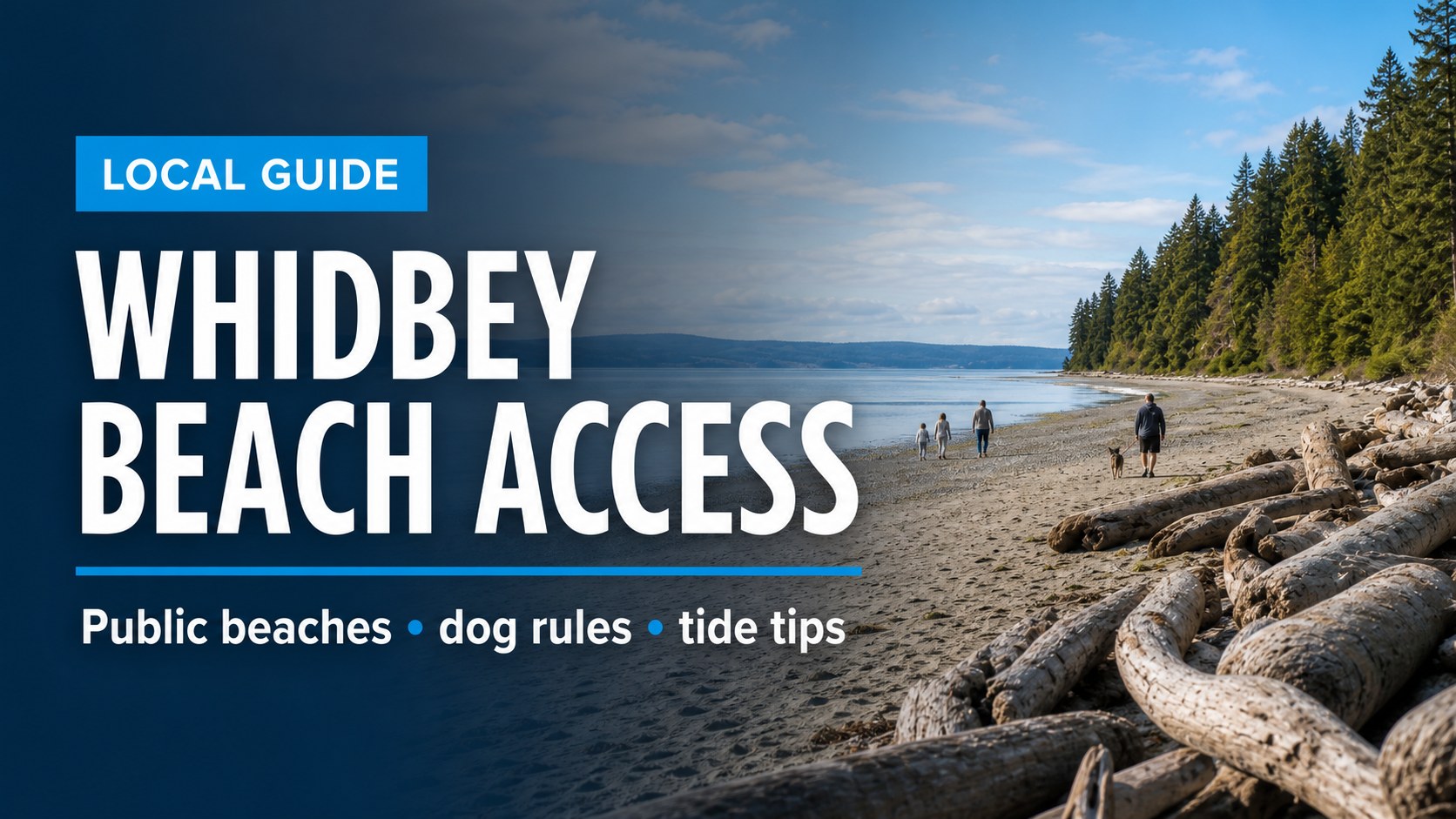
A good Whidbey beach day starts before you step onto the sand. The right public access point depends on what you want to do: walk the dog, picnic with kids, follow a bluff trail, beachcomb at low tide, watch the sunset, or simply find a quiet stretch of shoreline where the rules are clear.
Whidbey Island has public beaches, county parks, state parks, road-end access points, private shoreline, tidelands, shellfish rules, leash boundaries, parking limits, and tide conditions that can change the whole feel of a visit. This guide is meant to help you choose wisely, check the right sources, and enjoy the shoreline respectfully.
Quick Takeaways
- Double Bluff is the best-known South Whidbey beach for long sandy walks and off-leash dog access, but dogs must be leashed from the parking lot until the marked off-leash boundary.
- Fort Casey, Fort Ebey, and Joseph Whidbey are state parks, so plan around Discover Pass requirements and current park rules.
- Ebey’s Landing is a bluff-and-beach outing, not a casual flat beach stroll for every visitor.
- Shellfish harvesting is never a guess. Check current DOH, Island County, and WDFW information before harvesting.
- Not every shoreline is public. Public access points and private beach areas can sit close together on Whidbey.
Match the beach |
Before you go |
South Whidbey |
Central Whidbey |
North Whidbey |
Owning near the water |
FAQ
Match the Beach to the Day
Instead of asking for the single best beach on Whidbey, start with the day you want. A beach that is perfect for a low-tide walk may be less convenient for a picnic. A dramatic bluff trail may not be the right fit for a stroller. A dog-friendly beach may have specific boundaries that matter as soon as you leave the parking lot.

Dog Walk
Start with Double Bluff, then verify the current leash boundary and county rules before assuming your dog can be off leash.
Family Picnic
Look for restrooms, picnic tables, playgrounds, and simpler parking. Freeland Park and Maxwelton Park are practical South Whidbey examples.
Bluff Hike
Ebey’s Landing and Fort Ebey are better for walkers who want views, trail time, and a more active outing.
Low-Tide Walk
Check the tide first. Some Whidbey beaches open up dramatically at low tide and feel much tighter when the water is high.
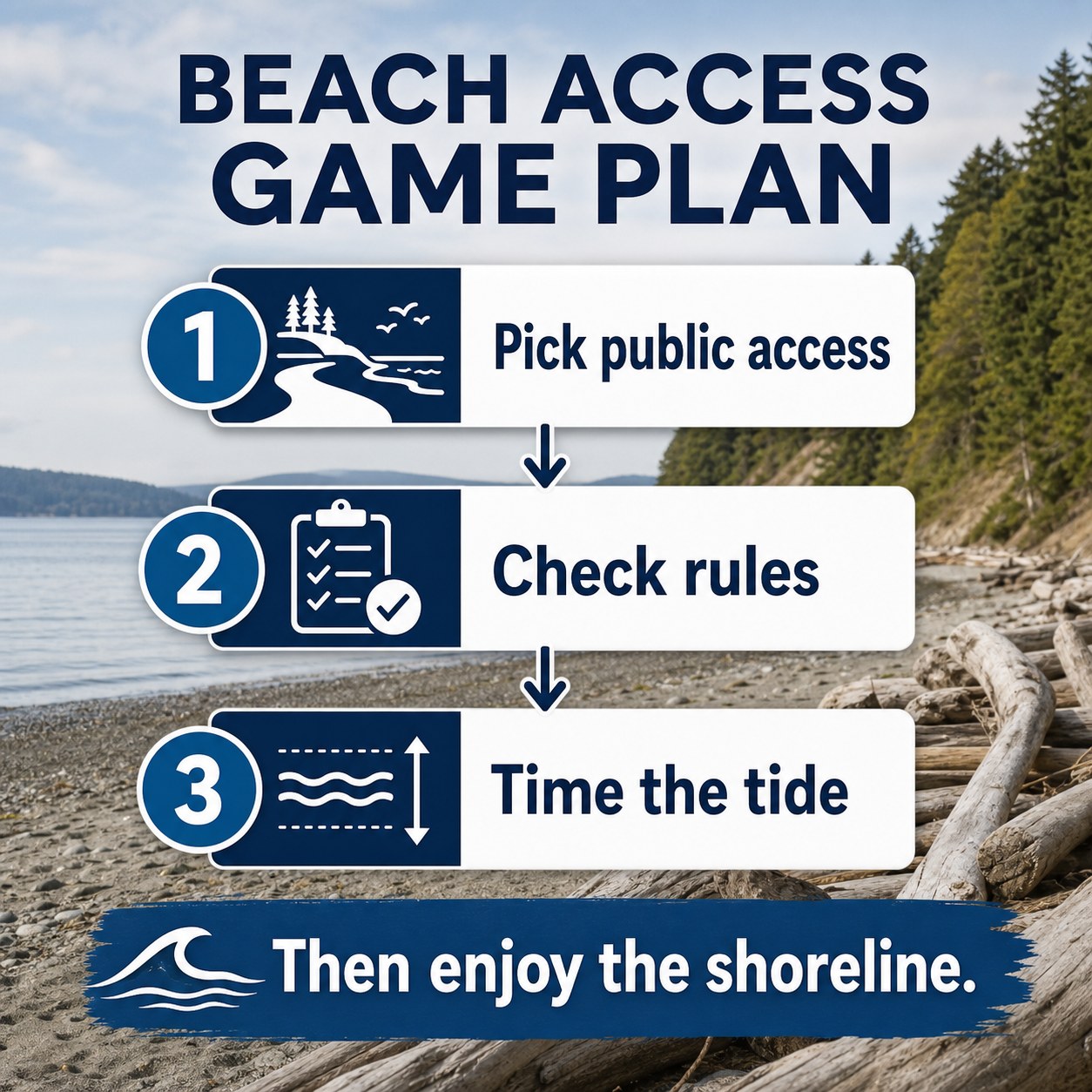
Before You Go: Four Checks That Save the Day
Whidbey beach access is not complicated, but it is local. The details matter: tide timing, dog rules, shellfish closures, parking, passes, and where public access ends. A few minutes of checking can prevent a frustrating trip.
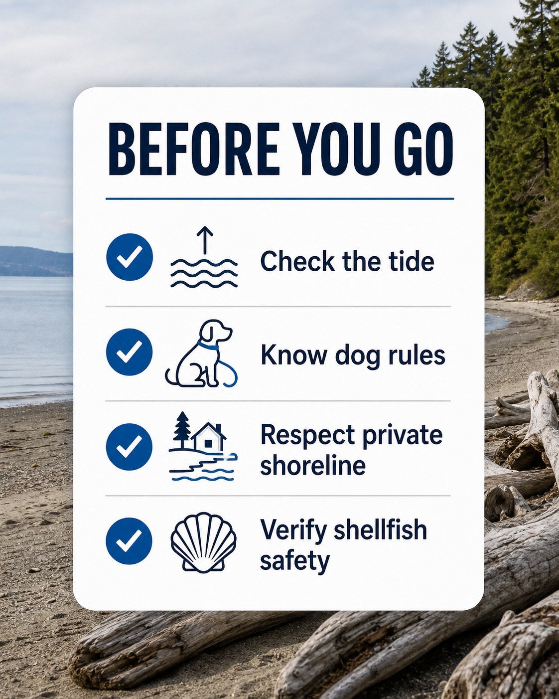
1. Check the tide
NOAA keeps current online tide predictions, and that is a better source than memory or a stale screenshot. Low tide can make a beach feel spacious and walkable; high tide can narrow the usable shoreline, cover tide flats, or make driftwood areas harder to navigate. Use the NOAA tide tables before planning a long beach walk or low-tide outing.
2. Know dog rules
Dog rules vary by location. At Double Bluff, FETCH notes that the off-leash area begins about 500 feet from the parking lot, with dogs required to stay leashed until the marked boundary. State parks generally require dogs to be on leash. Check the specific park or access point before turning a beach walk into a dog outing.
3. Respect private shoreline
Public access and private shoreline can sit close together on Whidbey. Island Beach Access describes public/private shoreline boundaries as a common point of confusion for walkers and boaters. Use signed access points, stay aware of boundaries, and avoid assuming that every beach-looking stretch is open to public use.
4. Verify shellfish safety
If harvesting shellfish is part of the plan, check both safety closures and harvest rules immediately before you go. The Washington State Department of Health shellfish closure tools, Island County shellfish advisories, and WDFW beach information should all be treated as live planning sources, not background reading.
South Whidbey: Sandy Walks, Family Parks, and Dog-Friendly Planning
South Whidbey has some of the island’s most approachable beach-day choices, especially if you are coming through Clinton, staying near Freeland, or building a day around local food, farms, and small-town stops. For trip pairing, the Whidbey farmers markets and farm stands guide can help you turn a beach walk into a picnic day.
Double Bluff
For many people, Double Bluff is the South Whidbey beach that comes to mind first. Island County describes it as a popular beach with an off-leash area, iconic views, and a wide shallow beach. It is a strong fit for long walks, big-sky views, and dog owners who understand the boundary rules.
The important detail: off leash does not mean off leash from the parking lot. FETCH notes that dogs must be leashed until the off-leash area begins, and that the boundary is marked near the beach. That makes Double Bluff excellent for dog people who plan well, but less ideal for anyone expecting instant off-leash freedom the second the car door opens.
Links: Island County park info | Double Bluff dog rules | WDFW shellfish beach profile | Double Bluff on Google Maps
Freeland Park
Freeland Park is more practical than dramatic, which is exactly why it belongs in a beach access guide. Island County lists amenities including a boat ramp and dock for non-commercial use, picnic areas, restrooms, playground, walking trails, and clamming when in season. For families or multi-generation groups, amenities can matter more than scenery.
Links: Island County park info | Freeland Park on Google Maps
Maxwelton Park
Maxwelton Park is another useful South Whidbey option, especially for people who want beach access with park infrastructure. Island County lists beach access, restrooms, picnic shelters, a playground, ballfield facilities, and views toward the shipping lanes, Olympic Mountains, and Kitsap Peninsula. It is a better fit for a planned gathering than a remote shoreline wander.
Links: Island County park info | Maxwelton Beach on Google Maps
If you are comparing South Whidbey communities as part of a move, the Clinton guide and Freeland guide can help connect beach access with everyday life, ferry timing, services, and neighborhood feel.
Central Whidbey: Bluffs, History, and Westside Views
Central Whidbey beach access often feels more layered: historic landscapes, bluff trails, state park rules, west-facing water, and changing weather. This is the part of the island where a beach day can become a hike, a history stop, or a sunset plan.
Ebey’s Landing
Ebey’s Landing is one of Whidbey’s signature bluff-and-beach experiences. The National Park Service describes the Bluff Loop Trail as a moderate beach-and-bluff walk with a few steep sections, marine ecosystems, views across the strait, and Perego’s Lake. It is not the simplest beach for every visitor, but it is one of the strongest choices when the goal is landscape, movement, and a sense of place.
Links: NPS Ebey’s Landing trail info | Ebey’s Landing on Google Maps
Fort Casey
Fort Casey Historical State Park combines beach exploration with military batteries, Admiralty Head Lighthouse, picnic areas, fishing, boating, and wide Admiralty Inlet views. Washington State Parks lists dogs as allowed on leash and shows standard state park fees, including Discover Pass requirements. It is a strong Central Whidbey choice when the group wants more than shoreline alone.
Links: Fort Casey State Park info | Fort Casey on Google Maps
For more Central Whidbey context, use the Coupeville guide, especially if you want to pair Fort Casey, Ebey’s Landing, Penn Cove, and Front Street into one slower day.
North Whidbey: State Parks, Sunsets, and Bigger Water
North Whidbey beach access often feels more open and wind-shaped. It can also be more state-park-oriented, which means passes, leash rules, seasonal hours, and official park alerts matter.
Fort Ebey
Fort Ebey State Park is a coastal camping park with a historic military fort, wooded trails, bluff views, and beach exploration. Washington State Parks lists 25 miles of wooded trails and notes that visitors can explore the beach, surf, picnic, and take in views of the Olympic Mountains, Vancouver Island, and the Strait of Juan de Fuca. Dogs are allowed on leash, and a Discover Pass is part of the normal parking picture.
Links: Fort Ebey State Park info | Fort Ebey on Google Maps
Joseph Whidbey State Park
Joseph Whidbey State Park is a day-use park on the west shore of Whidbey Island. State Parks describes it as a place for sunsets, moderate trail hiking, picnicking, and beach time with kids. It is seasonal, with summer hours listed as 8 a.m. to dusk and winter closure from November 1 through March 31, so check the park page before using it as a shoulder-season destination.
Links: Joseph Whidbey State Park info | Joseph Whidbey on Google Maps
For broader North Whidbey planning, the Oak Harbor guide is a good companion, especially if you are comparing parks, everyday services, Navy-area realities, and access north through Deception Pass.
Public Access, Private Shoreline, and Owning Near the Water
Beach access is not only a visitor question. It also matters when people are thinking about buying, selling, or owning near the water on Whidbey. Two homes can both feel close to the shoreline while offering very different realities: private tidelands, community beach access, public road-end access nearby, bluff conditions, erosion considerations, septic and well systems, or rules that affect how the shoreline can be used.
That is why local due diligence matters. If a listing mentions beach access, waterfront, tidelands, community beach, boat launch, or shoreline amenities, ask what those words mean in practice. Is access deeded, shared, public, private, seasonal, tide-dependent, or governed by a community association? Is the trail or stairway maintained? Are there bluff, drainage, erosion, septic, or insurance considerations?
For a broader ownership lens, read What to Know Before Buying a Home on Whidbey Island. Beach access is one part of the same larger pattern: island properties reward careful questions.
Thinking About a Home Near the Water?
A Whidbey shoreline setting can be beautiful, but the details matter: access, bluff conditions, septic, wells, roads, insurance, association rules, and long-term maintenance. Local guidance helps turn a pretty view into a clear decision.
Frequently Asked Questions
What is the best public beach on Whidbey Island?
It depends on the day. Double Bluff is a strong choice for sandy walks and dog planning, Ebey’s Landing is excellent for a bluff-and-beach hike, Fort Casey and Fort Ebey pair shoreline with state park scenery, and Freeland or Maxwelton can be more practical for picnics and family park amenities.
Are dogs allowed on Whidbey beaches?
Dogs are allowed at many Whidbey beach areas, but rules vary. Double Bluff has a marked off-leash area, while Washington State Parks generally require dogs to be on leash. Always check the current rule for the specific access point before you go.
Do I need a Discover Pass for Whidbey beaches?
You need a Discover Pass when parking at Washington State Parks and certain state-managed recreation lands. Fort Casey, Fort Ebey, Joseph Whidbey, South Whidbey State Park, and Deception Pass are state park examples where pass planning matters.
Should I check tides before going to a Whidbey beach?
Yes. Tide timing can change how much beach is usable, especially for long walks, tide flats, driftwood areas, and shellfish-related outings. NOAA tide predictions are the best starting point.
Can I harvest shellfish on Whidbey beaches?
Only when the beach, species, season, license requirements, and health status allow it. Check Washington State Department of Health, Island County, and WDFW resources immediately before harvesting. Conditions and closures can change quickly.
Image note: The visuals in this article are editorial guide images created to explain Whidbey beach access planning. They are not documentary photos from a specific park, beach, event, property, or access point.
Written by Si Fisher
