Facebook
 X
X
 Pinterest
 Copy Link
Whidbey Island Whale Watching from Shore: How to Follow Sightings and Read the Water

Image note: The visuals in this article are editorial guide images created to explain shore-based whale watching on Whidbey Island. They are not documentary photos from a specific place, event, business, property, or moment.
Whale watching from Whidbey Island’s shore is less about memorizing one “best” beach and more about learning how to use a moving sighting. Whales travel through Saratoga Passage, Admiralty Inlet, Possession Sound, Penn Cove, and nearby waterways on their own schedule. A report that was useful 20 minutes ago may point to a different viewing area now—or the whale may have changed direction or disappeared beneath the surface.
This guide explains how to follow current reports, read the water, choose a verified public viewpoint, use Langley’s Whale Bell, and share a useful sighting without promising that wildlife will appear on demand.
The quick answer
- Check the Orca Network Whale Sighting Network.
- Note the report’s time, location, direction, and side of the channel.
- Choose a safe, verified public viewpoint that fits the reported movement.
- Scan slowly with your eyes first, then use binoculars.
- Expect uncertainty. A sighting report is a clue, not a reservation.
Start with the sighting, not the viewpoint
Orca Network’s community-based Whale Sighting Network gathers reports from the public, partner organizations, volunteers, and scientists. Reports are reviewed and cross-checked, creating records that support research, conservation work, and alerts to vessels in busy waterways.
Before leaving for the shoreline, check the latest sighting resources and Orca Network’s Public Viewpoints Map. Check the timestamp before anything else. Whales can cover considerable water, reverse direction, pause to feed, or remain submerged long enough to frustrate even experienced observers.
How to read a Whidbey whale report
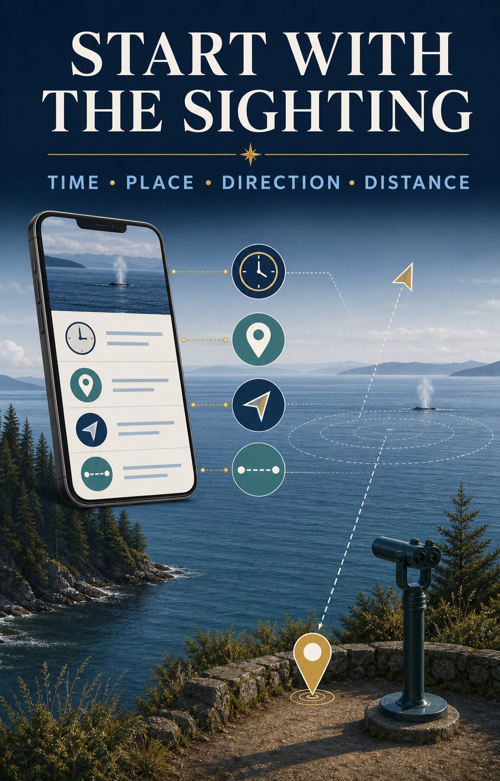
| Report detail | What it helps you decide |
|---|---|
| Time | Whether the report may still be actionable. |
| Place | Which waterway and public viewpoints make sense. |
| Direction | Where the whale may travel next if it maintains course. |
| Whidbey side, opposite shore, or mid-channel | Whether a shore view is realistic and which side offers the better angle. |
| Traveling, milling, or feeding | Whether movement may be steady or the whale may remain in one area. |
| Species or “unconfirmed” | What clues to watch for without forcing an identification. |
Illustrative example—not a live sighting:
“10:20 a.m.—two whales southbound past Sandy Point, Whidbey side of mid-channel, traveling steadily.”
The useful clues are the exact time, southbound direction, and position nearer Whidbey. A reader might consider a legal public viewpoint farther south, but only after checking travel time and current access. Do not race through neighborhoods or stop where parking is prohibited.
Four useful public-viewing zones
These are not ranked and none guarantees a whale. Match the waterway to the latest report, then confirm hours, parking, closures, and access on the official page before driving. For broader shoreline planning, use the Whidbey Island Beach Access Guide.
1. Langley waterfront: Saratoga Passage
Langley is the island’s most complete shore-watching starting point because it combines a waterfront sightline, the Whale Bell, and a staffed educational resource nearby. The Langley Whale Center at 105 Anthes Avenue shares current sighting information, local tips, and exhibits about Salish Sea marine mammals. At the final July 2026 verification, its posted hours were Wednesday through Sunday, 11 a.m.–4 p.m.; hours vary seasonally, so check before visiting. You can also open the Langley Whale Center in Google Maps.
Nearby Whale Bell Park and Seawall Park overlook Saratoga Passage. Visit the Whale Bell Park page, view Whale Bell Park in Google Maps, or explore more of Langley.
2. Bush Point: west-side Admiralty Inlet
When a current report places whales along South Whidbey’s west side or Admiralty Inlet, Bush Point can provide a useful public shoreline angle. Check the Port of South Whidbey facility page for current hours and access information, then use Google Maps for Bush Point. Remember that this is an active boat-ramp and fishing area; keep launch access clear.
3. Fort Casey: broad Admiralty Inlet views
Fort Casey offers broad shoreline and elevated sightlines across Admiralty Inlet. That can be useful when a report is distant or moving through the inlet, but binoculars may still be essential. Confirm park information with Washington State Parks and open Fort Casey in Google Maps. If you are making a day of Central Whidbey, use the Coupeville guide for nearby planning.
4. Clinton and Possession: southern waterways
Reports from Possession Sound or the Clinton ferry approach may make Clinton Beach Park or Possession Beach Waterfront Park relevant. Both facilities can carry changing notices, so use the official pages immediately before visiting. For directions, open Clinton Beach Park or Possession Beach Waterfront Park in Google Maps.
The Langley Whale Bell: look first, then ask which way
Whale Bell Park sits near First Street and Anthes Avenue in downtown Langley. Its memorable instruction is simple: see a whale, ring the bell. The sound invites everyone nearby to turn toward Saratoga Passage and start looking.
The bell is a local signal, not a guarantee that the whale will remain visible. If you hear it, scan the water first and then ask the most useful questions: Where was the whale? Which direction was it moving? How long ago was it seen? Was it close to the Whidbey side, near the opposite shore, or mid-channel?
If you are the person ringing the bell, share the time, approximate position, direction, and number of animals. Name the species only when you are confident or when a qualified observer has confirmed it. “Unconfirmed whale” is more useful than a confident but incorrect identification.
What you may see from shore
Gray whales
A returning group of gray whales known as the North Puget Sound “Sounders” has historically detoured into the region to feed, especially during spring. Gray whales are baleen whales that often feed on small prey in bottom sediments. Their surfacing can show a low, mottled back, a heart-shaped or bushy blow in suitable conditions, and sometimes a tail before a deeper dive.
Recent patterns are less tidy than an old seasonal calendar suggests: some Sounders have arrived earlier, stayed longer, or appeared during winter. Orca Network also reports serious conservation concerns for eastern North Pacific gray whales. Give any whale plenty of space and use the current gray whale information rather than relying on a fixed month.
Killer whales
A tall dorsal fin can be striking even at a distance, but shore observers should be cautious about identification. Bigg’s killer whales and endangered Southern Resident killer whales are distinct populations with different diets and movement patterns. A distant fin alone may not tell you which population you are seeing. Look for a verified report before repeating an identification.
Humpbacks and other marine mammals
Humpback whales and other cetaceans can also move through the greater Salish Sea. Harbor porpoises, seals, and sea lions are more common supporting characters. Distance, glare, waves, and floating logs can fool the eye, so watch for repeated, coordinated movement before deciding that a dark shape is an animal.
How to scan the water
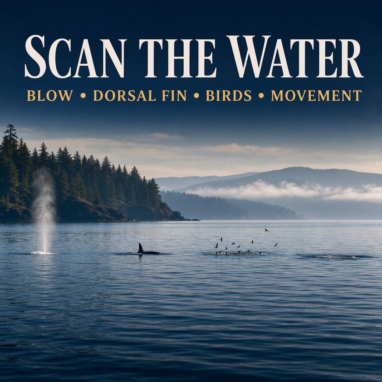
- Begin with your eyes. A wider field of view makes it easier to notice a blow or unusual surface movement.
- Divide the horizon into sections. Scan slowly from one reference point to the next rather than swinging binoculars randomly.
- Look for repetition. A blow, back, or fin followed by another surfacing along a consistent path is more useful than one unexplained splash.
- Watch the birds, but do not overread them. Concentrated bird activity can reveal feeding action or baitfish, but it does not automatically mean a whale is present.
- Use binoculars to confirm. An 8x or 10x pair is a practical shore-watching range for many people. Brace your elbows or use a railing where permitted.
- Stay with one area for several minutes. Whales spend much of their time below the surface and may reappear farther along their travel path.
Report what you saw
A useful report includes the date, exact time, location, direction of travel, estimated number of animals, observed behavior, and whether photographs are available. If you are unsure of the species, say so.
Submit your observation through Orca Network’s online whale-sighting report. These reports do more than help the next shore watcher: verified records support research and can help alert ferries and commercial vessels when whales are near busy waterways.
Watch responsibly from shore
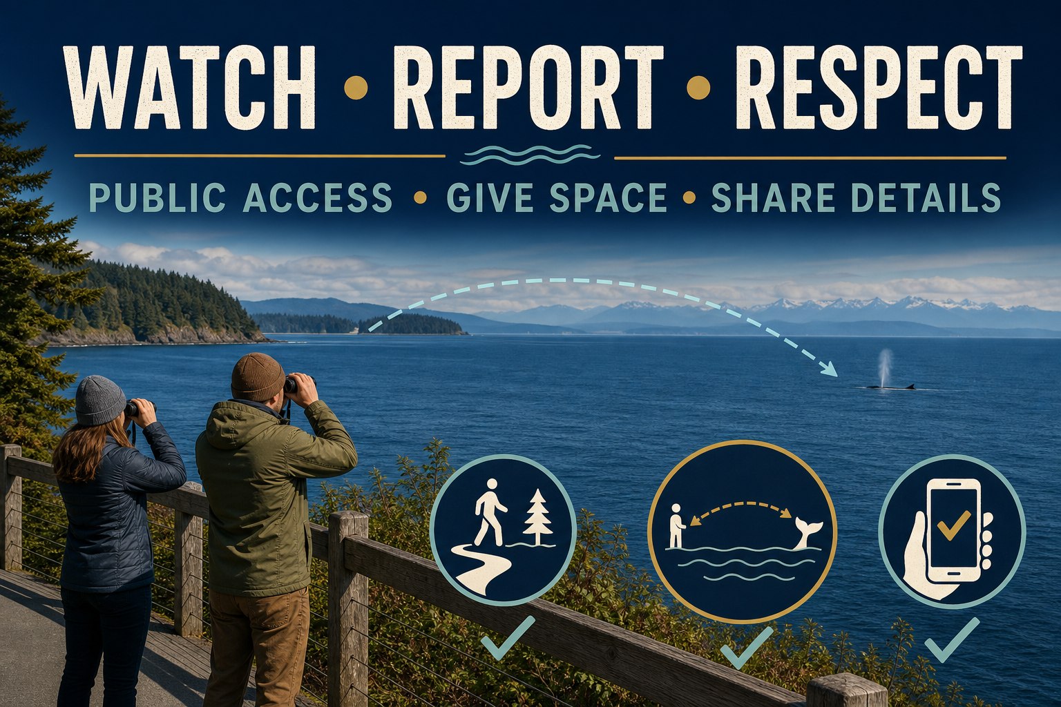
- Use established public access and legal parking; do not cut through private shoreline or residential property.
- Give seals, sea lions, nesting birds, and other wildlife ample room.
- Never feed, touch, call to, chase, or attempt to redirect wildlife.
- Do not launch a drone to get closer to marine mammals.
- If an animal appears distressed, stranded, entangled, injured, or dead, do not approach it. Use the NOAA West Coast Marine Mammal Stranding Network for current reporting guidance.
- If you switch from shore to a boat, kayak, or paddleboard, additional legal distances and operating rules apply. Review the current Be Whale Wise regulations and guidelines before getting on the water.
A realistic 60-minute shore-watching plan
- 5 minutes: Check the newest sighting and the official access page.
- 10 minutes: Travel only to a safe public viewpoint that fits the report. If the drive is longer, reconsider whether the sighting is still actionable.
- 35 minutes: Scan in sections, recheck likely zones, and enjoy the wider waterfront scene.
- 5 minutes: Record useful details if a whale appears.
- 5 minutes: Submit a report—and if no whale appears, leave with the satisfaction of having spent an attentive hour beside the Salish Sea.
Frequently asked questions
What is the best time of year to see whales from Whidbey Island?
Spring is historically associated with North Puget Sound gray whales known as the Sounders, but recent arrival and departure patterns vary. Killer whales and other cetaceans may appear at different times. Current sighting reports are more useful than relying on one guaranteed season.
Where is the Langley Whale Bell?
Whale Bell Park is near First Street and Anthes Avenue in downtown Langley, overlooking Saratoga Passage and close to Seawall Park and the Langley Whale Center.
What does it mean when the Langley Whale Bell rings?
Someone nearby has spotted a whale and is alerting others to look. Scan immediately, then ask where the whale was seen and which direction it was traveling. The bell does not guarantee the animal is still visible.
Where can I find current Whidbey whale sightings?
Start with Orca Network’s Whale Sighting Network, its recent reports, and its Public Viewpoints Map. The Langley Whale Center can also provide current sighting context and local tips during open hours.
Can I see whales from the Clinton–Mukilteo ferry?
It is possible to spot marine mammals from a ferry, but it is never dependable. Treat any sighting as a bonus, remain in authorized passenger areas, and do not let whale watching interfere with boarding, unloading, or crew instructions.
What binoculars are useful for whale watching from shore?
Many shore watchers find 8x or 10x binoculars practical. Start with your unaided eyes to locate movement, then use binoculars to confirm details. A stable stance matters as much as magnification.
Should I report a whale sighting?
Yes. Record the exact time, location, direction, estimated number of animals, behavior, and whether photos are available. Submit the details to Orca Network, and label the species unconfirmed when you are unsure.
What should I do if I see a stranded or distressed whale?
Keep people and pets away, do not touch or attempt to move the animal, and report it through the NOAA West Coast Marine Mammal Stranding Network. Follow instructions from authorized responders.
The best shore-watching habit is attention
Check the report, read the direction, use public access, and give the water time. Whether a whale surfaces or not, the process makes you more aware of the living waterways around Whidbey Island.
Continue planning with the Whidbey Island Beach Access Guide or Guide to Langley.

Information and public notices were last verified July 27, 2026. Wildlife activity, hours, access conditions, closures, and regulations can change. Check linked official sources before visiting.
Written by Si Fisher
Whidbey Island Camping Guide: Campgrounds, Reservations & Tips

Camping on Whidbey Island is less about finding the one “best” campground and more about choosing the right base for the kind of trip you want. North Whidbey puts you close to Deception Pass and an activity-rich state park setting. Central Whidbey offers coastal trails and quieter historic surroundings. South Whidbey has a practical near-town campground option for tent and RV travelers.
Use this guide to compare the main public campground choices, understand what to verify before leaving home, and avoid an easy mix-up: South Whidbey State Park is day-use only, not an overnight campground.
Image note: The visuals in this article are editorial guide images created to explain Whidbey camping planning. They are not documentary photos from a specific place, event, business, property, or moment.
Quick planning note: Campground availability, burn restrictions, route conditions, ferry service, and site details can change. Check the official campground page and live travel tools immediately before your trip.
Coming from the mainland? Start with the dedicated Whidbey ferry guide before you finalize your arrival plan.
Quick comparison: choose your Whidbey camping base
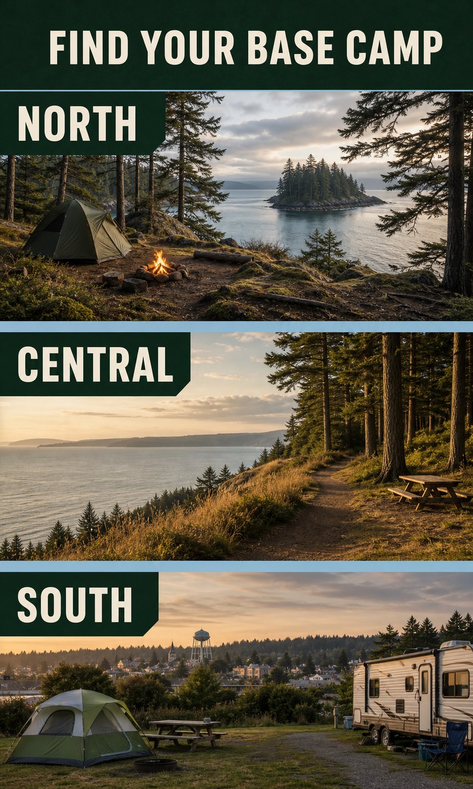
North Whidbey: Deception Pass State Park
Best for campers who want forest, water, trails, beach exploration, and a full state-park base camp. It is the most activity-rich option of the three, so checking current alerts and site details matters.
Central Whidbey: Fort Ebey State Park
Best for coastal views, wooded trails, military history, and an easy Central Whidbey base near Coupeville and Oak Harbor. It is a strong fit for a slower trip built around walking, beach time, and exploring nearby towns.
South Whidbey: Whidbey Island Fairgrounds Campground
Best for tent or RV campers who want a practical near-town base close to Langley, with published hookups, showers, and easy access to South Whidbey errands, meals, and evening plans.
Deception Pass State Park: for a full North Whidbey base camp
Deception Pass State Park is a natural choice when your camping trip centers on trails, shoreline, forest, freshwater, and saltwater access. The park lists camping, accessible campsites, restrooms, showers, drinking water, fire pits, and a trailer dump among its amenities.
It is also a place where current conditions matter. Before driving up, check the official park page for alerts, burn restrictions, trail or parking limitations, and the site information that applies to your tent, trailer, or RV. Do not assume a vehicle that fits one campground loop will fit every parking area or campsite.
Open Deception Pass State Park in Google Maps
Fort Ebey State Park: for coastal trails and Central Whidbey access
Fort Ebey State Park is a coastal camping park with wooded trails, beach access, open views, and the distinctive atmosphere of a former military site. The park describes 25 miles of wooded trails, along with camping, showers, drinking water, accessible campsites, and nearby beach exploration.
One useful local detail belongs in your planning conversation: the official park page notes that NAS Whidbey training flights may create aircraft noise above the campground at various times. That will not bother every visitor, but it is worth knowing before choosing a site for a quiet reset.
If you are building a Central Whidbey itinerary, pair your stay with the local context in Your Guide to Coupeville and the practical shoreline details in the Whidbey Island Beach Access Guide.
Open Fort Ebey State Park in Google Maps
Whidbey Island Fairgrounds Campground: for a South Whidbey, near-town stay
The Whidbey Island Fairgrounds Campground in Langley is currently identified by the Port of South Whidbey as the only public campground on South Whidbey. It is a practical choice when you want to camp without being far from town.
The campground lists 20 RV sites with power and/or water hookups, tent camping, private-shower bathrooms, a dump station, and online registration and payment. Its published 2026 rates are $25 per night for tent camping with a car, $40 for regular RV sites, and $50 for premium RV sites; always confirm rates, site availability, event-period conditions, and rules directly with the campground before booking.
For a South Whidbey stay, the location can make it easier to add a meal, harbor stroll, or village stop without turning the trip into a long drive. Explore the broader local context in the Guide to Langley.
Open Whidbey Island Fairgrounds Campground in Google Maps
What to reserve and verify before you leave
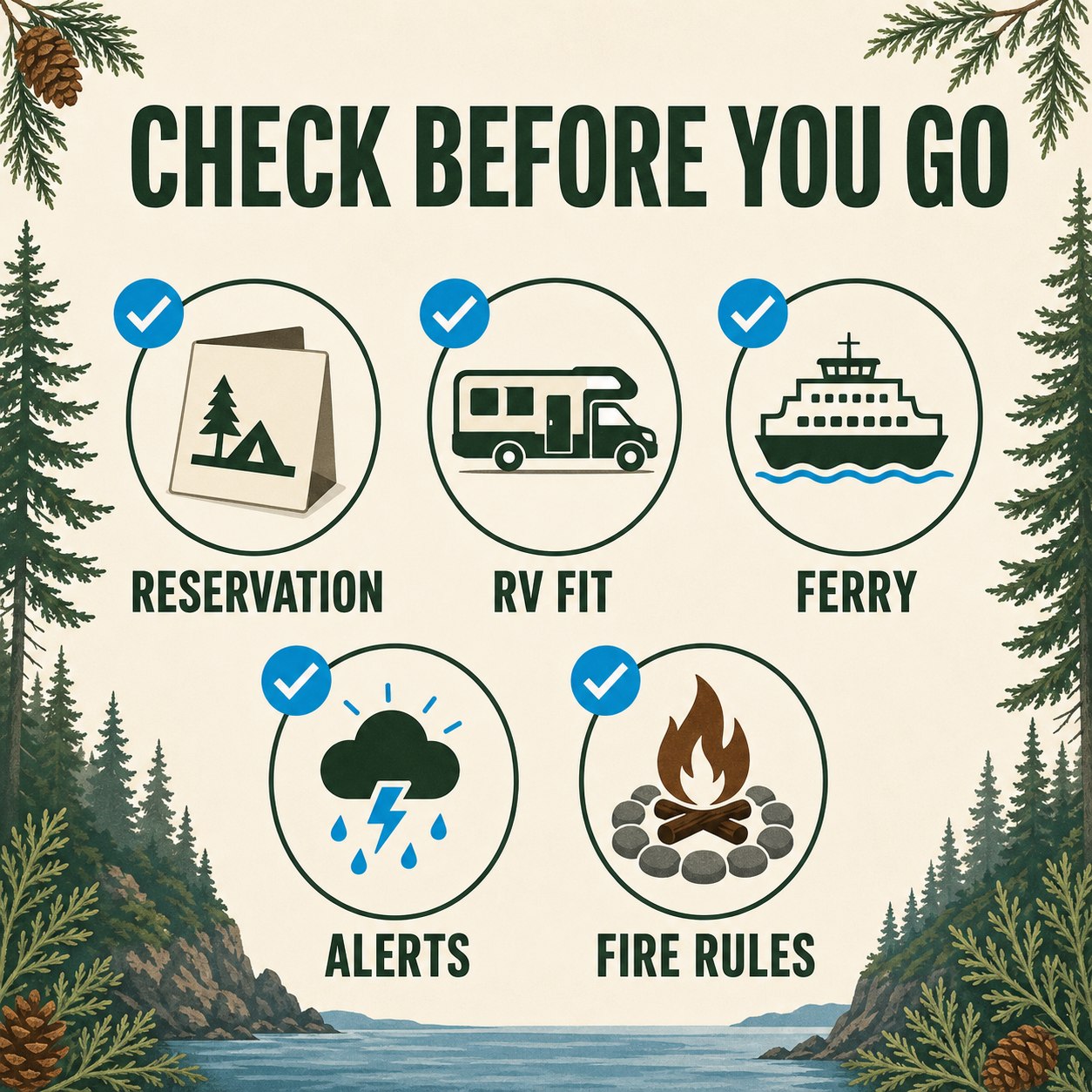
- Reservation and site fit: Know your dates, party size, tent count, vehicle length, trailer length, and whether you need hookups. Washington State Parks says reservations can be made up to nine months ahead, while same-day campsite reservations may be possible until 2 p.m. when space remains. Review State Parks reservation guidance.
- Alerts and fire rules: Check the official park page on travel day. Conditions, burn restrictions, water availability, trail access, and parking limits can change.
- Ferry or route plan: Use Washington State Ferries live tools for schedule and service updates. Vehicle reservations are available on the Port Townsend–Coupeville route; a ticket does not guarantee a particular sailing on every route.
- Passes: State Parks says overnight campers do not need a Discover Pass to park in the state park where they are staying. A pass may still be needed for day-use parking at other state recreation lands. Review Discover Pass details.
- Quiet-hours expectations: State park campers should plan for check-in and checkout rules, leash requirements, and quiet hours. These basics help everyone have a better stay. Review current State Parks camping rules.
A simple three-day Whidbey camping rhythm
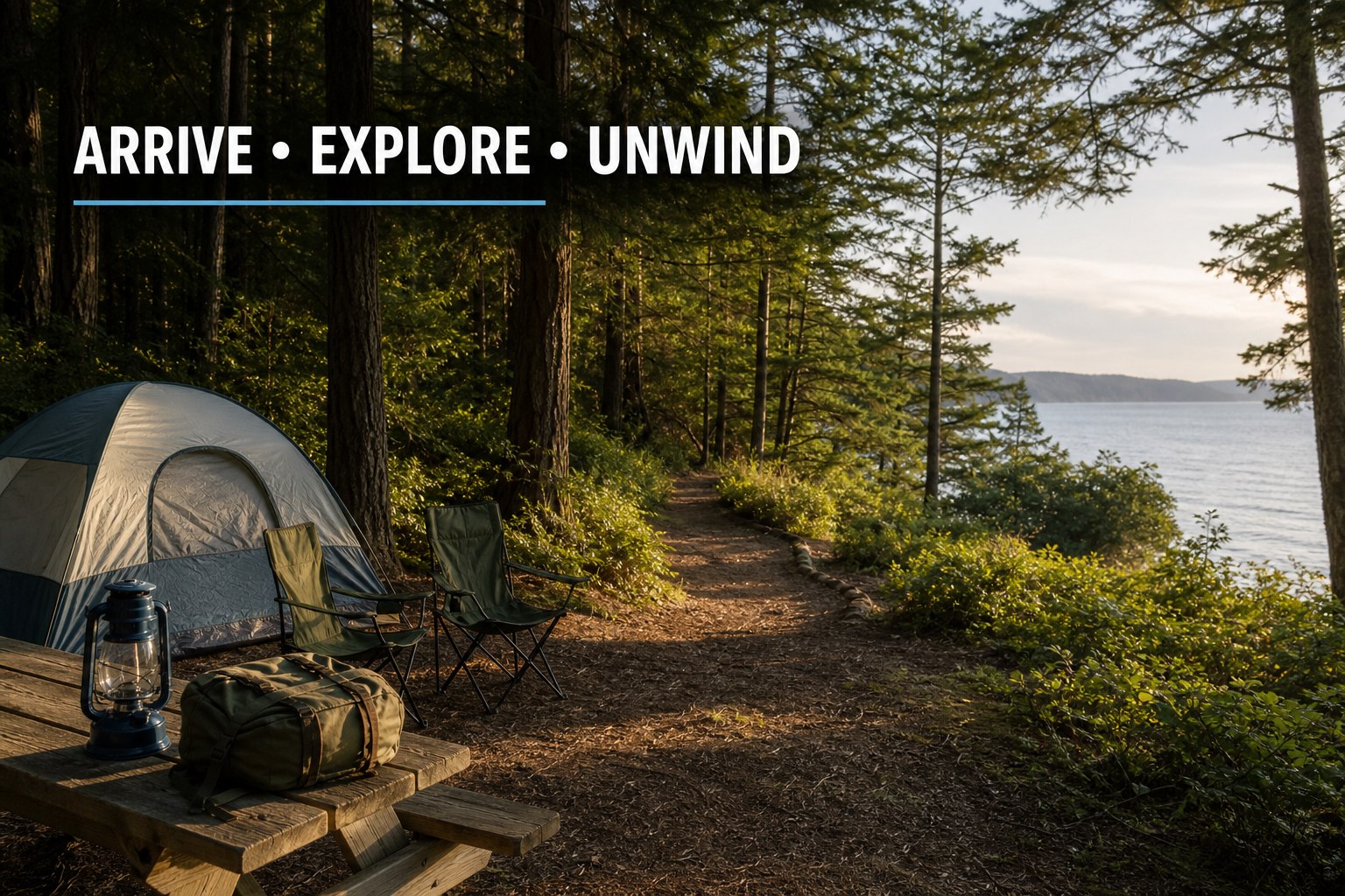
Day 1: Arrive and settle in. Keep the first afternoon simple. Set up camp, take a nearby short walk, and learn the immediate layout before trying to fit in a major island outing.
Day 2: Choose one anchor adventure. Make one park, trail, beach, town, or water activity the center of the day. Whidbey feels better when there is time for detours, weather changes, and a slower meal.
Day 3: Leave room for the return trip. Check ferry status or your northbound route before packing up. A final short walk or nearby shoreline stop is usually a better finish than overloading the last morning.
Camping versus imagining a longer Whidbey stay
A camping trip is one of the best ways to notice the practical rhythms that a quick day trip can hide: travel distances, morning fog, evening quiet, park access, nearby services, ferry timing, and the pace that feels right for your household. If a weekend here starts to feel like more than a getaway, explore homes for sale on Whidbey Island when it is useful—not as a substitute for spending time in the places that fit your life.