Facebook
 X
X
 Pinterest
 Copy Link
Whidbey Island Fall Birding Guide: Shorebirds, Wetlands, and Where to Watch

Image note: The visuals in this article are editorial guide images created to explain fall birding on Whidbey Island. They are not documentary photos from a specific place, event, business, property, or moment.
By late August, Whidbey Island may still feel like summer—but along its lagoons, wetlands, and tidal flats, fall migration is already changing the view. Southbound shorebirds pause to feed and rest, waterfowl begin gathering, and patient observers can watch flocks reshape themselves as the tide advances.
A productive outing is not about memorizing a long species list or racing between every reported bird. It starts with three choices: pick the right habitat, check the tide, and give the birds enough space to keep feeding. This beginner-friendly guide focuses on three useful Whidbey birding zones—Crockett Lake and Keystone Spit, Deer Lagoon, and Dugualla Bay Preserve—and a simple method you can reuse throughout the season.
The quick answer
- Start at Crockett Lake for the broadest beginner-friendly mix of lake, spit, tidal water, and open sightlines.
- Try a rising tide. Low tide exposes feeding habitat but may scatter birds far away; a rising tide often moves them toward the remaining mud edge.
- Bring binoculars. A spotting scope helps across wide flats, but it is not required for a first outing.
- Scan before identifying. Notice size, bill shape, leg length, feeding motion, and flock behavior before opening an app.
- Protect the birds’ energy. Keep your distance, leash dogs where they are permitted, skip recorded calls, and stay on legal public access.
Field checklist
Before you go
A five-minute check can prevent a wasted drive and a disrupted flock.
-
Check the official access page -
Look up the nearest NOAA tide -
Bring binoculars and a weather layer -
Choose one habitat, not all three -
Leave recorded bird calls off -
Have a backup if parking is full
Why Whidbey works for fall migration
Whidbey sits along the Pacific Flyway, a broad migration corridor connecting northern breeding grounds with wintering areas farther south. The island’s value comes from variety packed into a relatively narrow landscape: protected lagoons, freshwater and brackish wetlands, saltwater bays, exposed mudflats, spits, beaches, and forest edges.
For a migrating bird, these places are not scenic rest stops in the human sense. They are places to replace energy. Tidal mud can hold tiny invertebrates and other food; shallow water offers different feeding depths; nearby marshes and uplands provide cover and resting space. That is why the best birding strategy is habitat-first rather than species-first.
The Whidbey Camano Land Trust’s fall shorebird guide highlights Deer Lagoon and Crockett Lake among the region’s productive tidal areas. Current reports can help refine expectations, but migration remains dynamic: weather, tide, food, disturbance, and the birds themselves all affect what appears.
Four field terms in plain language
- Mudflat
- Tidal ground exposed as water recedes. It can look empty from a distance while holding food for many birds.
- Shorebird
- A broad birding term for sandpipers, plovers, and related birds that commonly feed along mud, sand, or shallow water. It does not mean every bird seen near shore.
- Roost
- A place where birds rest safely, including the higher edges they may gather on when feeding flats are covered.
- Playback
- A recording of a bird’s song or call played from a phone or speaker to make a wild bird respond or come closer.
Read the tide before choosing a viewing window
There is no single perfect tide for every species or location. Still, tide stage gives you a useful starting point:
- Low tide: More feeding ground is exposed, but birds can spread across a large flat and remain distant.
- Rising tide: Water gradually covers the outer mud, often concentrating feeding birds along the shrinking edge. This can create a practical viewing window.
- High tide: Much of the feeding flat may disappear. Look for birds gathering at safe roosting edges, while ducks and other waterbirds may remain visible on open water.
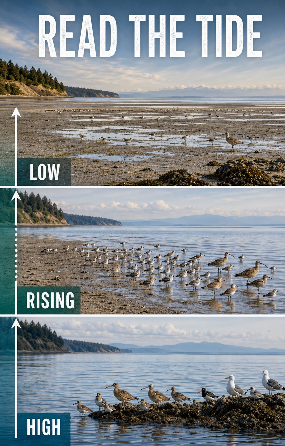
Use the NOAA tide-prediction station list to choose the station nearest your destination and select the date of your outing. For Central Whidbey, the Coupeville predictions are a useful planning reference. For North Whidbey, check the Crescent Harbor station. Local water levels and bird behavior can differ from a simple rule of thumb, so arrive ready to observe what is actually happening.
If your outing includes shoreline walking, also review the Whidbey Island Beach Access Guide for public-access, tide, dog-rule, and private-property reminders.
Three Whidbey habitats to watch
These locations are not ranked by guaranteed sightings—there are no guarantees in birding. They offer three different habitat combinations and enough contrast to teach you what to look for.
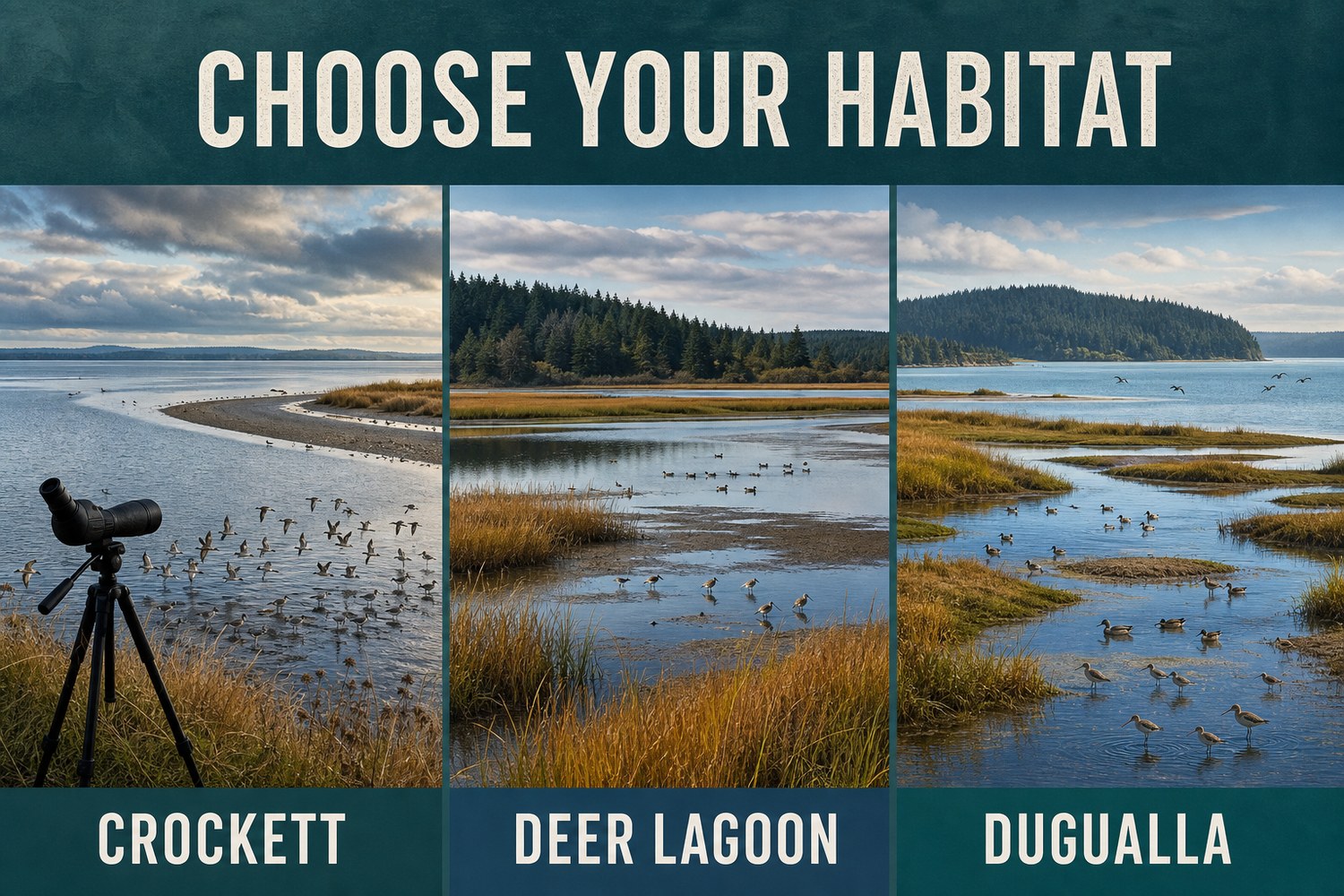
| Viewing zone | Habitat advantage | Best fit | Planning note |
|---|---|---|---|
| Crockett Lake + Keystone Spit | Lake, tidal flat, spit, beach, and open water | A first Whidbey birding outing | Check Fort Casey access and pass information |
| Deer Lagoon | Lagoon, marsh, mudflat, open water, and woods | Watching mixed shorebirds and waterfowl | Very limited residential parking; protect privacy |
| Dugualla Bay Preserve | Restored wetland, channels, brackish water, and bay | A North Whidbey habitat-focused outing | Confirm current preserve conditions before visiting |
Central Whidbey · Best first outing
1. Crockett Lake and Keystone Spit
Best for: Broad sightlines and several habitats from one general area.
Scan: Mud and shallow margins for shorebirds, open water for ducks, and posts or sky for raptors.
Access cue: Confirm Fort Casey notices and vehicle-pass requirements before leaving.
Crockett Lake is a natural starting point because one viewing area can place several habitats in front of you. The Whidbey Camano Land Trust describes the 423-acre Crockett Lake Preserve as a Pacific Flyway stop used by more than 230 bird species across the year.
Keystone Spit separates Crockett Lake from Admiralty Bay, adding protected-water and saltwater perspectives. A bird-viewing platform associated with nearby Fort Casey can make stationary scanning easier than walking toward a flock. Review the current Fort Casey State Park page, then open the Crockett Lake birding area in Google Maps.
For a longer Central Whidbey day, use the Guide to Coupeville rather than adding extra birding stops merely to fill an itinerary.
South Whidbey · Rich mixed habitat
2. Deer Lagoon
Best for: Comparing shorebirds, waders, ducks, and woodland-edge birds.
Scan: Wet mud, shallow water, open lagoon, marsh edges, and the wooded approach.
Access cue: Parking is very limited in residential areas; keep roads and driveways clear.
Deer Lagoon lies along Useless Bay east of Freeland. The Whidbey Audubon Society’s Deer Lagoon guide describes a documented list of at least 211 species and a combination of marsh, mudflat, open water, and surrounding woods. It is especially useful for comparing feeding styles: small birds probing wet mud, longer-legged birds working shallows, and ducks using deeper water.
The common entry points are in quiet residential areas, and neighboring yards and beaches may be private. Carpool when practical, remain on recognized public access, and choose another destination if legal parking is unavailable. Open Deer Lagoon in Google Maps for general orientation, then follow Audubon’s access guidance rather than improvising a shoreline route.
North Whidbey · Restored wetland
3. Dugualla Bay Preserve
Best for: A habitat-focused North Whidbey outing.
Scan: Channels and mud edges for shorebirds, open water for ducks, and nearby perches for raptors.
Access cue: Confirm current preserve directions and conditions with the Land Trust.
At Dugualla Bay, restored wetland and tidal habitats create another migration stop with a different feel. The Whidbey Camano Land Trust’s current Dugualla Preserves page identifies 201 protected acres with public access and bird-viewing opportunities.
Use Google Maps for Dugualla Bay Preserve, but check the Land Trust page before leaving. If you want food, services, or another non-birding stop nearby, the Guide to Oak Harbor can help with the rest of the day.
What to watch for without memorizing every bird
Fall shorebirds can be challenging because many are small, fast-moving, and dressed in subtler nonbreeding plumage. Begin with structure and behavior rather than forcing an immediate species name:
- Small flocking sandpipers: Compare body size, bill length, leg color, and whether they probe, peck, or chase retreating water.
- Longer-legged waders: Notice water depth, bill shape, and whether the bird stands and waits or walks continuously while feeding.
- Ducks and other waterbirds: Watch whether they dabble at the surface, tip forward, or dive completely.
- Raptors: Check fence posts, snags, and open sky. A sudden synchronized flock lift may mean a predator is nearby, but it can also result from disturbance.
Species such as Western Sandpipers, Least Sandpipers, Dunlin, Sanderlings, dowitchers, and other migrants may occur in suitable Whidbey habitat, but no guide can promise what will be present on a particular visit. “Small sandpiper” is a valid field note until you have enough evidence to be more specific.
Light and wind can matter as much as distance
Work around glare
When practical, choose a viewpoint with the sun beside or behind you. Looking directly into reflected light can hide bill shape, leg color, and subtle plumage. Change your angle before walking closer.
Expect wind
Wind can shake binoculars and scopes and may push birds toward sheltered edges. Brace your elbows, lower a tripod, and scan protected shorelines rather than assuming the birds have left.
Dress for a stationary outing
Standing still beside exposed water can feel cooler than the parking area. Bring a wind-resistant layer and keep the visit comfortable enough that you can watch patiently.
A 20-minute beginner scan
- Minutes 0–3: stop and listen. Let the area settle after your arrival. Notice alarm calls, flock movement, and where exposed mud meets shallow water.
- Minutes 3–7: scan without binoculars. Find the largest groups, moving waterlines, isolated perches, and obvious differences in bird size.
- Minutes 7–14: sweep slowly with binoculars. Move left to right in overlapping sections. Pause at flock edges, where a different species may stand apart.
- Minutes 14–18: study one bird or flock. Record size, bill, legs, feeding motion, and nearby species before consulting an identification tool.
- Minutes 18–20: recheck the whole scene. Tide and flock position may already have changed.
Simple gear that helps
Bring binoculars, a weather layer, water, and a notebook or phone for observations. A spotting scope is useful across broad mudflats, but a first outing can be rewarding with ordinary 8x or 10x binoculars. Avoid stepping closer just because your optics cannot resolve a bird.
Use recent reports as context, not a chase list
eBird Hotspots can show recent visits and the species birders have reported at shared public locations. Use that information to understand what is moving through the area—not as permission to enter closed or private land, crowd a rare bird, or expect yesterday’s sighting to remain.
Merlin Bird ID can help narrow possibilities using location, date, appearance, and sound. Make your own observations first. Sound identification is a clue, not proof, especially when several birds are calling or the recording is faint.
Watch without disrupting migration
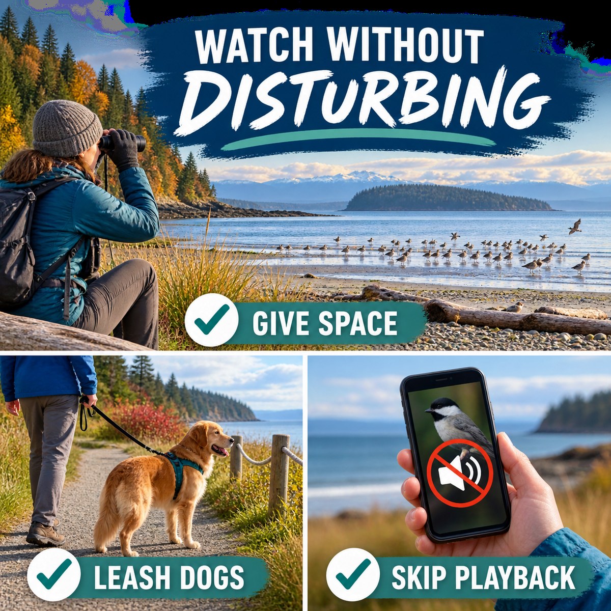
A shorebird on migration has a limited energy budget. Repeatedly forcing a flock to stop feeding or take flight can consume energy it needs for the next leg of the journey. Follow the American Birding Association Code of Birding Ethics and current U.S. Fish & Wildlife Service shorebird guidance:
- Let behavior set the distance. If birds stop feeding, become alert, move away, or take flight because of you, back up.
- Use established public access. Do not cross private yards, beaches, fields, fences, or closed restoration areas.
- Keep dogs leashed where dogs are allowed. Check site rules first; for a bird-focused outing, leaving a dog at home is often the least disruptive choice.
- Skip recorded bird calls. Playing a song or call from a phone or speaker to make a wild bird respond or approach is called playback. A bird may treat the sound as a rival, mate, flock member, or warning and stop feeding, leave cover, or spend energy searching for a bird that is not there. The Audubon playback explainer notes that continuous or loud playback is especially poor practice. For this migration outing, keep identification audio inaudible to wild birds—use headphones or wait until you have left the viewing area.
- Do not fly a drone near flocks. An aerial object can trigger escape behavior even when the operator remains far away.
- Share carefully. Do not post directions that encourage trespassing or crowding at a sensitive location.
A realistic 60-minute fall birding plan
- Before leaving: Check the official access page, weather, and NOAA tide prediction. Choose one location rather than three.
- First 10 minutes: Park legally, settle in, and identify the main habitat zones without approaching birds.
- Next 35 minutes: Repeat the 20-minute scan, then study one flock or feeding edge as the tide changes.
- Next 10 minutes: Review your notes with Merlin Bird ID or recent eBird context.
- Final 5 minutes: Leave the site quieter than you found it and record uncertainties along with confident identifications.
Frequently asked questions
When is fall bird migration on Whidbey Island?
Southbound migration is already underway by late summer and continues through fall, but different species move on different schedules. Weather, tide, food, and disturbance can change what is present from day to day.
Which tide is best for watching shorebirds?
A rising, mid-level tide is often useful because it can move feeding birds toward the remaining mud edge. At low tide birds may spread far across exposed flats, while high tide can cover much of the feeding habitat. Conditions vary by location, so check NOAA predictions and observe the site.
Where should a beginner start birding on Whidbey?
Crockett Lake and Keystone Spit are a strong first choice because the area combines lake, mudflat, spit, beach, and open-water habitats with broad viewing opportunities. Check the Crockett Lake Preserve and Fort Casey pages before visiting.
Do I need binoculars or a spotting scope?
Binoculars make a major difference, and many birders find 8x or 10x magnification practical. A spotting scope helps with distant birds on broad flats, but it is optional. Never close the distance if doing so disrupts the birds.
Can I bring a dog while birdwatching?
Check the rules for the specific site. Where dogs are permitted, keep them leashed and well away from feeding or resting flocks. Leaving a dog at home is often the most wildlife-friendly choice for a shorebird outing.
How can I check recent bird sightings?
Use eBird’s Explore and Hotspot tools to review recent public reports, then confirm access through the official land manager. Treat reports as context rather than a guarantee or permission to enter private or closed areas.
What is bird-call playback, and why should I avoid it?
Playback means playing a recorded song or call from a phone or speaker to make a wild bird respond or come closer. Birds may interpret it as a rival, mate, flock member, or warning and stop feeding, leave cover, or spend energy investigating. Use headphones for identification audio or wait until you have left the viewing area.
Is parking easy at these birding locations?
It varies. Deer Lagoon has especially limited parking in residential areas, so keep driveways and roads clear and choose another site if legal parking is unavailable. Check official pages for current access, closures, and parking information before leaving.
Are particular bird sightings guaranteed?
No. Migration changes daily, and even a recently reported bird may have moved. A successful outing is learning to read habitat and behavior while observing whatever is present without disturbance.
Choose one habitat and give it time
A quieter outing often reveals more than a hurried islandwide checklist. Check the tide, settle into one legal viewpoint, and watch how birds respond to water, weather, and one another.
Continue planning with the Whidbey Island Beach Access Guide, the Guide to Coupeville, or the Guide to Oak Harbor.

Planning sources
- Whidbey Camano Land Trust: Crockett Lake Preserve
- Whidbey Audubon Society: Deer Lagoon
- Whidbey Camano Land Trust: Dugualla Preserves
- NOAA Tide Predictions
- U.S. Fish & Wildlife Service: Shorebird Migration Tracking
- American Birding Association Code of Birding Ethics
- Audubon: How to Use Bird-Call Apps
Information and public-access details were last verified August 18, 2026. Migration activity, tide conditions, parking, hours, closures, pass requirements, and site rules can change. Check linked official sources before visiting.
Written by Si Fisher
Whidbey Island Whale Watching from Shore: How to Follow Sightings and Read the Water

Image note: The visuals in this article are editorial guide images created to explain shore-based whale watching on Whidbey Island. They are not documentary photos from a specific place, event, business, property, or moment.
Whale watching from Whidbey Island’s shore is less about memorizing one “best” beach and more about learning how to use a moving sighting. Whales travel through Saratoga Passage, Admiralty Inlet, Possession Sound, Penn Cove, and nearby waterways on their own schedule. A report that was useful 20 minutes ago may point to a different viewing area now—or the whale may have changed direction or disappeared beneath the surface.
This guide explains how to follow current reports, read the water, choose a verified public viewpoint, use Langley’s Whale Bell, and share a useful sighting without promising that wildlife will appear on demand.
The quick answer
- Check the Orca Network Whale Sighting Network.
- Note the report’s time, location, direction, and side of the channel.
- Choose a safe, verified public viewpoint that fits the reported movement.
- Scan slowly with your eyes first, then use binoculars.
- Expect uncertainty. A sighting report is a clue, not a reservation.
Start with the sighting, not the viewpoint
Orca Network’s community-based Whale Sighting Network gathers reports from the public, partner organizations, volunteers, and scientists. Reports are reviewed and cross-checked, creating records that support research, conservation work, and alerts to vessels in busy waterways.
Before leaving for the shoreline, check the latest sighting resources and Orca Network’s Public Viewpoints Map. Check the timestamp before anything else. Whales can cover considerable water, reverse direction, pause to feed, or remain submerged long enough to frustrate even experienced observers.
How to read a Whidbey whale report
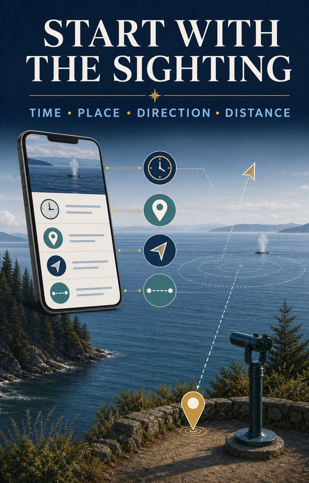
| Report detail | What it helps you decide |
|---|---|
| Time | Whether the report may still be actionable. |
| Place | Which waterway and public viewpoints make sense. |
| Direction | Where the whale may travel next if it maintains course. |
| Whidbey side, opposite shore, or mid-channel | Whether a shore view is realistic and which side offers the better angle. |
| Traveling, milling, or feeding | Whether movement may be steady or the whale may remain in one area. |
| Species or “unconfirmed” | What clues to watch for without forcing an identification. |
Illustrative example—not a live sighting:
“10:20 a.m.—two whales southbound past Sandy Point, Whidbey side of mid-channel, traveling steadily.”
The useful clues are the exact time, southbound direction, and position nearer Whidbey. A reader might consider a legal public viewpoint farther south, but only after checking travel time and current access. Do not race through neighborhoods or stop where parking is prohibited.
Four useful public-viewing zones
These are not ranked and none guarantees a whale. Match the waterway to the latest report, then confirm hours, parking, closures, and access on the official page before driving. For broader shoreline planning, use the Whidbey Island Beach Access Guide.
1. Langley waterfront: Saratoga Passage
Langley is the island’s most complete shore-watching starting point because it combines a waterfront sightline, the Whale Bell, and a staffed educational resource nearby. The Langley Whale Center at 105 Anthes Avenue shares current sighting information, local tips, and exhibits about Salish Sea marine mammals. At the final July 2026 verification, its posted hours were Wednesday through Sunday, 11 a.m.–4 p.m.; hours vary seasonally, so check before visiting. You can also open the Langley Whale Center in Google Maps.
Nearby Whale Bell Park and Seawall Park overlook Saratoga Passage. Visit the Whale Bell Park page, view Whale Bell Park in Google Maps, or explore more of Langley.
2. Bush Point: west-side Admiralty Inlet
When a current report places whales along South Whidbey’s west side or Admiralty Inlet, Bush Point can provide a useful public shoreline angle. Check the Port of South Whidbey facility page for current hours and access information, then use Google Maps for Bush Point. Remember that this is an active boat-ramp and fishing area; keep launch access clear.
3. Fort Casey: broad Admiralty Inlet views
Fort Casey offers broad shoreline and elevated sightlines across Admiralty Inlet. That can be useful when a report is distant or moving through the inlet, but binoculars may still be essential. Confirm park information with Washington State Parks and open Fort Casey in Google Maps. If you are making a day of Central Whidbey, use the Coupeville guide for nearby planning.
4. Clinton and Possession: southern waterways
Reports from Possession Sound or the Clinton ferry approach may make Clinton Beach Park or Possession Beach Waterfront Park relevant. Both facilities can carry changing notices, so use the official pages immediately before visiting. For directions, open Clinton Beach Park or Possession Beach Waterfront Park in Google Maps.
The Langley Whale Bell: look first, then ask which way
Whale Bell Park sits near First Street and Anthes Avenue in downtown Langley. Its memorable instruction is simple: see a whale, ring the bell. The sound invites everyone nearby to turn toward Saratoga Passage and start looking.
The bell is a local signal, not a guarantee that the whale will remain visible. If you hear it, scan the water first and then ask the most useful questions: Where was the whale? Which direction was it moving? How long ago was it seen? Was it close to the Whidbey side, near the opposite shore, or mid-channel?
If you are the person ringing the bell, share the time, approximate position, direction, and number of animals. Name the species only when you are confident or when a qualified observer has confirmed it. “Unconfirmed whale” is more useful than a confident but incorrect identification.
What you may see from shore
Gray whales
A returning group of gray whales known as the North Puget Sound “Sounders” has historically detoured into the region to feed, especially during spring. Gray whales are baleen whales that often feed on small prey in bottom sediments. Their surfacing can show a low, mottled back, a heart-shaped or bushy blow in suitable conditions, and sometimes a tail before a deeper dive.
Recent patterns are less tidy than an old seasonal calendar suggests: some Sounders have arrived earlier, stayed longer, or appeared during winter. Orca Network also reports serious conservation concerns for eastern North Pacific gray whales. Give any whale plenty of space and use the current gray whale information rather than relying on a fixed month.
Killer whales
A tall dorsal fin can be striking even at a distance, but shore observers should be cautious about identification. Bigg’s killer whales and endangered Southern Resident killer whales are distinct populations with different diets and movement patterns. A distant fin alone may not tell you which population you are seeing. Look for a verified report before repeating an identification.
Humpbacks and other marine mammals
Humpback whales and other cetaceans can also move through the greater Salish Sea. Harbor porpoises, seals, and sea lions are more common supporting characters. Distance, glare, waves, and floating logs can fool the eye, so watch for repeated, coordinated movement before deciding that a dark shape is an animal.
How to scan the water
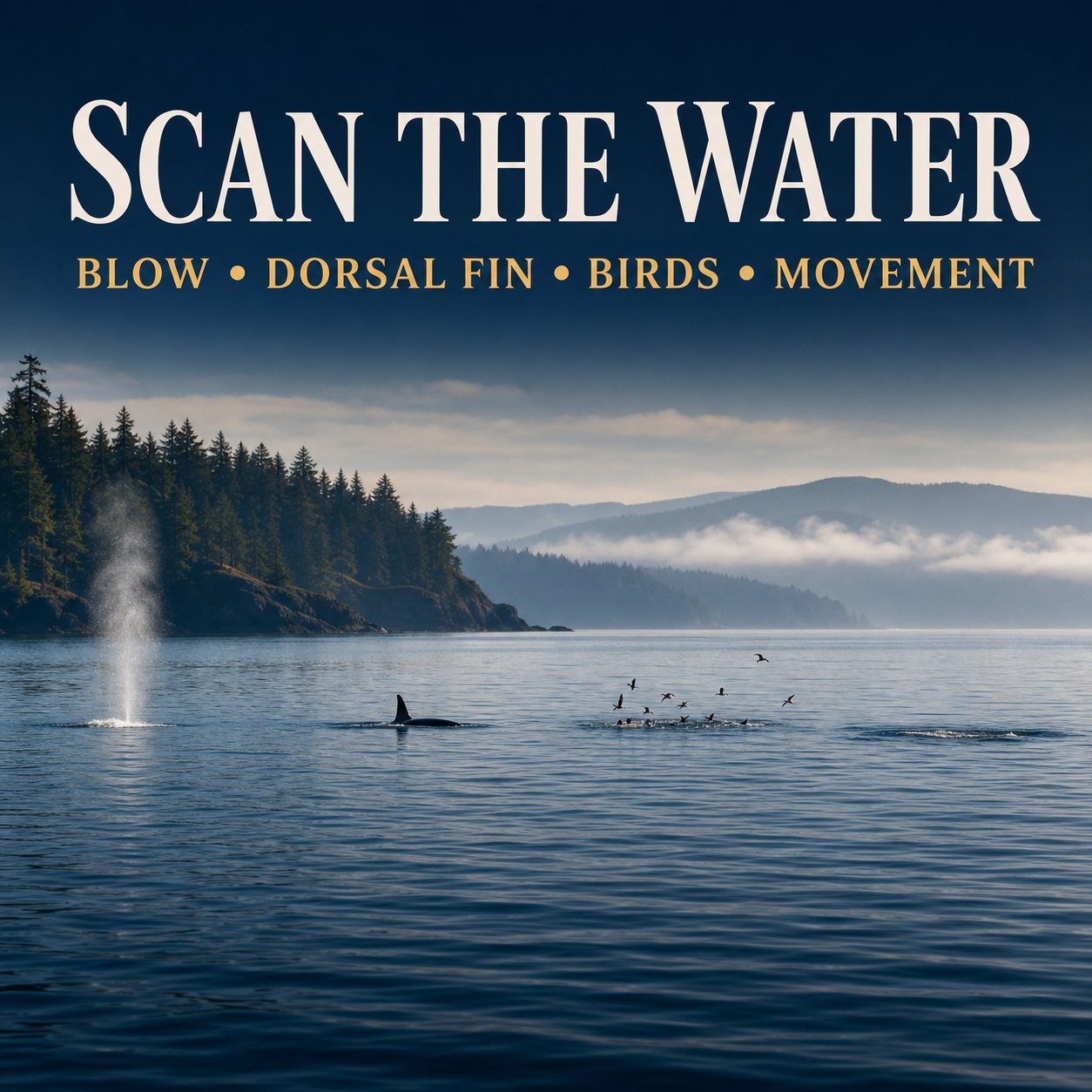
- Begin with your eyes. A wider field of view makes it easier to notice a blow or unusual surface movement.
- Divide the horizon into sections. Scan slowly from one reference point to the next rather than swinging binoculars randomly.
- Look for repetition. A blow, back, or fin followed by another surfacing along a consistent path is more useful than one unexplained splash.
- Watch the birds, but do not overread them. Concentrated bird activity can reveal feeding action or baitfish, but it does not automatically mean a whale is present.
- Use binoculars to confirm. An 8x or 10x pair is a practical shore-watching range for many people. Brace your elbows or use a railing where permitted.
- Stay with one area for several minutes. Whales spend much of their time below the surface and may reappear farther along their travel path.
Report what you saw
A useful report includes the date, exact time, location, direction of travel, estimated number of animals, observed behavior, and whether photographs are available. If you are unsure of the species, say so.
Submit your observation through Orca Network’s online whale-sighting report. These reports do more than help the next shore watcher: verified records support research and can help alert ferries and commercial vessels when whales are near busy waterways.
Watch responsibly from shore
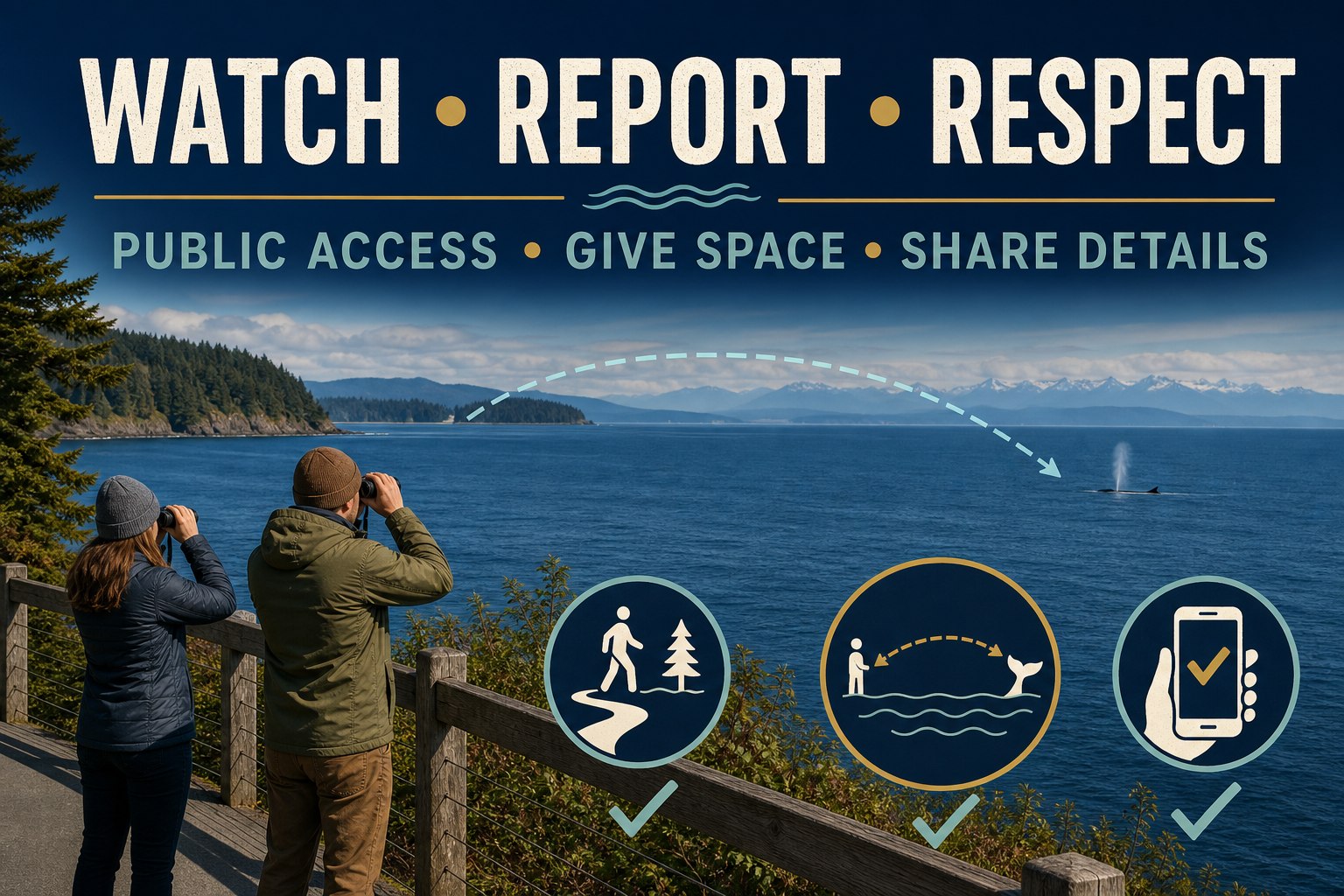
- Use established public access and legal parking; do not cut through private shoreline or residential property.
- Give seals, sea lions, nesting birds, and other wildlife ample room.
- Never feed, touch, call to, chase, or attempt to redirect wildlife.
- Do not launch a drone to get closer to marine mammals.
- If an animal appears distressed, stranded, entangled, injured, or dead, do not approach it. Use the NOAA West Coast Marine Mammal Stranding Network for current reporting guidance.
- If you switch from shore to a boat, kayak, or paddleboard, additional legal distances and operating rules apply. Review the current Be Whale Wise regulations and guidelines before getting on the water.
A realistic 60-minute shore-watching plan
- 5 minutes: Check the newest sighting and the official access page.
- 10 minutes: Travel only to a safe public viewpoint that fits the report. If the drive is longer, reconsider whether the sighting is still actionable.
- 35 minutes: Scan in sections, recheck likely zones, and enjoy the wider waterfront scene.
- 5 minutes: Record useful details if a whale appears.
- 5 minutes: Submit a report—and if no whale appears, leave with the satisfaction of having spent an attentive hour beside the Salish Sea.
Frequently asked questions
What is the best time of year to see whales from Whidbey Island?
Spring is historically associated with North Puget Sound gray whales known as the Sounders, but recent arrival and departure patterns vary. Killer whales and other cetaceans may appear at different times. Current sighting reports are more useful than relying on one guaranteed season.
Where is the Langley Whale Bell?
Whale Bell Park is near First Street and Anthes Avenue in downtown Langley, overlooking Saratoga Passage and close to Seawall Park and the Langley Whale Center.
What does it mean when the Langley Whale Bell rings?
Someone nearby has spotted a whale and is alerting others to look. Scan immediately, then ask where the whale was seen and which direction it was traveling. The bell does not guarantee the animal is still visible.
Where can I find current Whidbey whale sightings?
Start with Orca Network’s Whale Sighting Network, its recent reports, and its Public Viewpoints Map. The Langley Whale Center can also provide current sighting context and local tips during open hours.
Can I see whales from the Clinton–Mukilteo ferry?
It is possible to spot marine mammals from a ferry, but it is never dependable. Treat any sighting as a bonus, remain in authorized passenger areas, and do not let whale watching interfere with boarding, unloading, or crew instructions.
What binoculars are useful for whale watching from shore?
Many shore watchers find 8x or 10x binoculars practical. Start with your unaided eyes to locate movement, then use binoculars to confirm details. A stable stance matters as much as magnification.
Should I report a whale sighting?
Yes. Record the exact time, location, direction, estimated number of animals, behavior, and whether photos are available. Submit the details to Orca Network, and label the species unconfirmed when you are unsure.
What should I do if I see a stranded or distressed whale?
Keep people and pets away, do not touch or attempt to move the animal, and report it through the NOAA West Coast Marine Mammal Stranding Network. Follow instructions from authorized responders.
The best shore-watching habit is attention
Check the report, read the direction, use public access, and give the water time. Whether a whale surfaces or not, the process makes you more aware of the living waterways around Whidbey Island.
Continue planning with the Whidbey Island Beach Access Guide or Guide to Langley.
Information and public notices were last verified July 27, 2026. Wildlife activity, hours, access conditions, closures, and regulations can change. Check linked official sources before visiting.
Written by Si Fisher