Facebook
 X
 Pinterest
 Copy Link
Whidbey Island Storm Season Guide: Power Outages, Wind, High Tides, and Ferry Disruptions
Image note: The visuals in this article are editorial guide images created to explain Whidbey Island storm and power-outage planning. They are not documentary photos from a specific place, event, business, property, or moment.
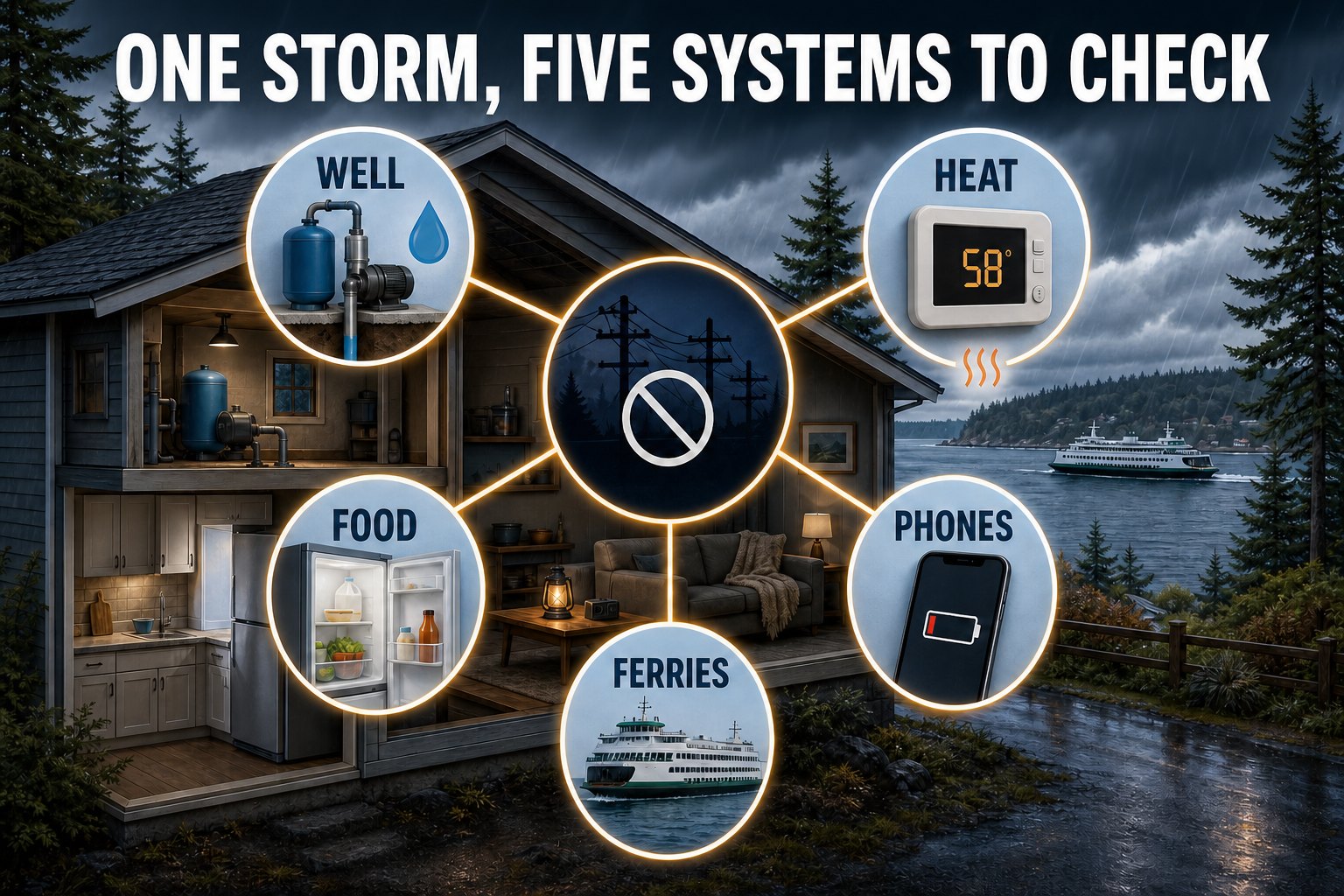
On Whidbey Island, a storm can become more than a bad-weather day. A power outage may also stop a private well pump, interrupt heat and communications, spoil food, complicate medical-device use, close roads, and disrupt one or both ferry routes. The useful question is not simply “Do I own an emergency kit?” It is “What should I check next, for this home, on this part of the island?”
This guide puts the core live tools together first, then walks through a practical sequence for the 48 hours before a windstorm, the final 12 hours, the outage itself, and the return of power. Conditions and official instructions can change quickly, so use the live panel as a starting point—not as a replacement for Island County, the National Weather Service, Washington State Ferries, or Puget Sound Energy.
[whidbey_storm_status]
The quick answer
Check these four things first
- Weather: Read the active NWS alerts for Island County, including timing and the actions in the alert.
- Power: Use the official PSE outage map and report your outage if needed.
- Travel: Check Washington State Ferries for Mukilteo–Clinton and Port Townsend–Coupeville service alerts.
- Water: If shoreline property or a low coastal route is involved, compare the nearest NOAA tide prediction with local weather and official flood guidance.
Prepare in stages, not all at once
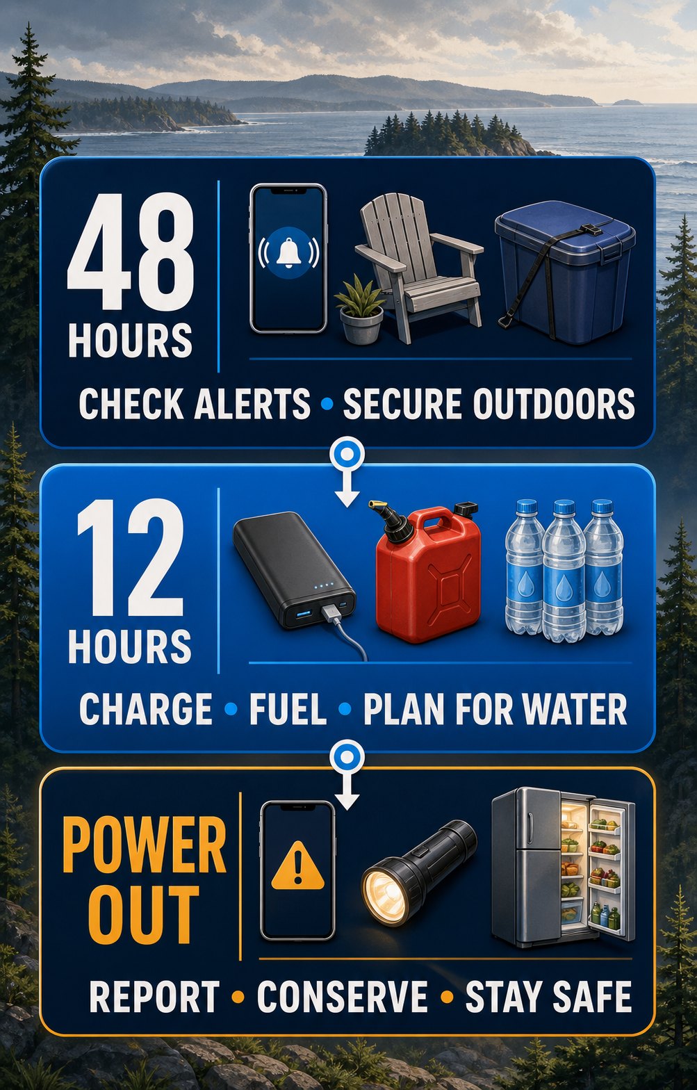
A useful storm plan changes as confidence in the forecast grows. Forty-eight hours out is the time to solve household problems. Twelve hours out is the time to finish charging, check live conditions, and avoid unnecessary travel. Once power is out, the priority shifts to electrical safety, heat, water, food, and reliable information.
Whidbey homeowners
Own a home on Whidbey?
Curious to know what it is worth in today’s market? Request a complimentary home valuation from a local Windermere Whidbey professional.
About 48 hours before
Solve the household problems
- Sign up for Island County myAlerts if you have not already.
- Secure outdoor furniture, cans, tools, and decorations before winds rise.
- Charge battery banks and test flashlights, CO alarms, and backup equipment.
- Fuel the vehicle; stations, card readers, and pumps may be affected by outages.
- Make a specific plan for well water, refrigerated medication, pets, mobility needs, and electrically powered medical equipment.
About 12 hours before
Shift to live conditions
- Read the full NWS alert, not only the headline, and note the expected timing.
- Recheck ferry alerts, road conditions, and any tidal restrictions before traveling.
- Fill clean water containers if your well pump will stop without power.
- Freeze water or gel packs and group freezer items together.
- Bring loose items, devices, medication, pet supplies, and lighting into the part of the home where you expect to stay.
Do this now, not during the storm
Learn the manual parts of your home
Know how to release the electric garage door, where the electrical panel and water shutoffs are, which heat sources work without utility power, and how your well or pressure tank behaves during an outage. Label instructions so another household member can use them. If a system is unfamiliar, arrange professional guidance before severe weather—not while it is failing.
When the power goes out on Whidbey
First determine whether the problem appears limited to your home. Check the electrical panel only if it is safe and dry. If the neighborhood is dark or you see utility damage, use PSE’s official outage tools. Island County notes that outages can disrupt communications, water, transportation, stores, fuel access, food storage, and medical devices—several systems that island households may rely on at the same time.
First 15 minutes
Use this order
- Look and listen for immediate danger. Stay indoors and away from windows if winds are high. Do not investigate falling trees or damaged lines.
- Report and verify. Use the PSE outage page, then conserve phone battery rather than repeatedly refreshing it.
- Protect the home. Turn off or unplug sensitive electronics and heat-producing appliances. Leave one light on so you know when service returns.
- Protect water. If you use a private well, conserve stored and pressure-tank water until you understand what is available.
- Protect cold food. Keep refrigerator and freezer doors shut and write down the outage start time.
Downed line: stay at least 35 feet away
PSE says to assume every downed utility wire is energized, stay at least 35 feet away, and call 911 or the utility. Do not drive over a line or attempt to rescue a person or pet near it. If a line falls on your vehicle, stay inside unless fire or another immediate hazard forces evacuation; follow emergency instructions.
Food safety has a clock
The FDA says an unopened refrigerator keeps food cold for about four hours. A full freezer holds temperature for about 48 hours, or about 24 hours when half full, if the door stays closed. When power returns, use appliance and food temperatures—not smell or appearance alone—to make decisions. The FDA advises discarding refrigerated perishables that have been above 40°F for four hours or more. Read the FDA’s current outage food-safety guidance for the full decision process.
Where to find food, warmth, charging, and community help
During a prolonged Whidbey Island outage, churches, nonprofits, community centers, neighbors, and generator-powered businesses sometimes provide hot meals, coffee, warmth, Wi-Fi, or device charging. The important catch is that storm-specific help is usually activated case by case. A place that helped during one outage may be closed, without power, or serving a different population during the next one.
Confirm before you leave
Check that the location is open, that the specific service you need is available, and that your route is safe. Never drive around barricades or approach floodwater, unstable trees, or downed lines to reach a resource. Call 911 for an immediate threat to life or safety; 211 is an information and referral service, not emergency dispatch.
During an active emergency
Start with Island County
Check Island County Alerts & Warnings for activated facilities, public instructions, road information, and Communication Hub updates. The county has identified public libraries as possible hub locations, but says operational details are still being developed.
Sign up for Island County myAlerts before storm season so time-sensitive notices can reach you directly.
Food, shelter, and essential needs
Ask Washington 211 what is open now
Washington 211 connects residents with current meal, pantry, shelter, warming, utility-assistance, and other community resources.
Call: 211 or 1-877-211-9274
Text: 211WAOD to 898211
Online: Search the resource directory
Standing Whidbey meal and daytime-support resources
The following are standing community programs rather than guaranteed storm shelters. Hours and services were checked on August 25, 2026, but outages, holidays, staffing, and program changes can affect availability. Call or check the linked page before traveling.
| Area | Resource | Standing service | Verify and locate |
|---|---|---|---|
| North Whidbey | SPiN Café 1241 SW Barlow Street, Oak Harbor 360-682-5949 |
Open daily 6:30 a.m.–5 p.m.; offers meals, daytime respite, and connections to community resources. Confirm the current meal schedule. | Official website Google Maps |
| North Whidbey | St. Augustine Catholic Church 185 N Oak Harbor Street, Oak Harbor 360-675-2303 |
Agape hot meal Monday evenings; Island County currently lists service from 4:30–6 p.m. | Official ministry page Google Maps |
| Central Whidbey | Coupeville United Methodist Church 608 N Main Street, Coupeville 360-678-4256 |
Island Senior Resources senior lunch Wednesdays from 11:45 a.m.–12:30 p.m. | Official website Google Maps |
| South Whidbey | Island Church of Whidbey 503 Cascade Avenue, Langley 360-221-6980 |
Free hot meals Tuesdays and Thursdays from 11:30 a.m.–1 p.m.; no eligibility restriction is currently listed. | Current program listing Google Maps |
| South Whidbey | St. Anthony’s Soup Kitchen at St. Hubert 804 3rd Street, Langley 360-221-5303 |
Island County currently lists Wednesday lunch from 11 a.m.–1 p.m. | County meal directory Google Maps |
For food banks and additional programs—including North Whidbey Help House, Good Cheer Food Bank, Gifts from the Heart, Queen-Bee Pantry, Whidbey Island Nourishes, and senior meal services—use the Island County food-bank and meal-program directory.
Watch for verified storm pop-ups
Whidbey businesses and neighbors sometimes create temporary gathering places when a long outage develops. During the December 2025 outage, Pickles Deli operated with generator power, heat, Wi-Fi, coffee, food, and a community meal fund. In December 2024, Bearly Awake Coffee Co. served residents from a generator-powered setup at Windjammer Park. These are examples of Whidbey’s community response—not standing promises for the next storm. Look for current, dated announcements and verify them before leaving home.
Generator safety: outside means fully outside
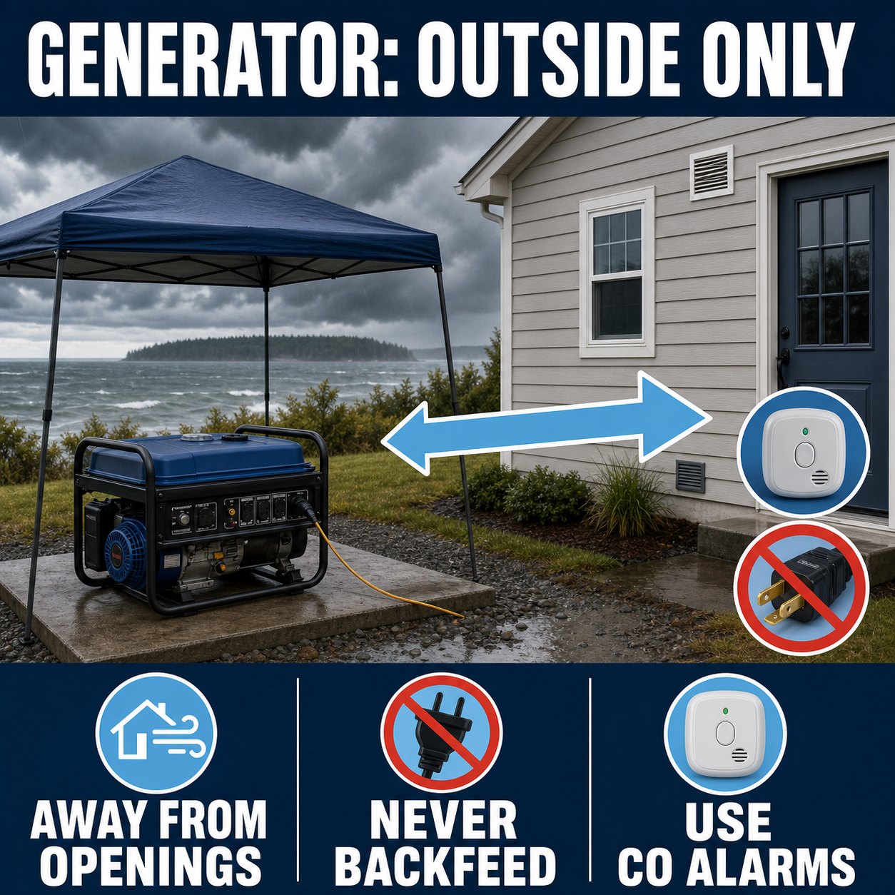
A garage with its door open is not a safe generator location. Neither is a porch, carport, breezeway, crawlspace, or partly enclosed shed. Operate a portable generator fully outdoors and away from doors, windows, and vents, following the manufacturer’s directions. PSE advises keeping the unit on a dry surface under an open canopy-like cover in wet weather and at least 10 feet from combustible surfaces.
- Use working carbon-monoxide alarms. Test them before storm season and replace batteries or units according to their instructions.
- Do not backfeed. Never plug a generator into a wall outlet or directly into home wiring. Backfeeding can energize utility lines and kill a lineworker.
- Use the correct connection. Plug appliances directly into the generator or use a properly rated, intact outdoor cord. A permanent connection requires a correctly installed transfer switch and qualified professional.
- Keep it dry and cool. Do not operate in standing water or touch it with wet hands. Shut it down and let it cool before refueling.
- Do not improvise placement. The PSE generator-safety page and the manufacturer’s instructions should govern the setup.
A high tide is not the whole flood forecast
Island County describes king tides as higher-than-usual tides that can produce local flooding even without rain. But a tide table is only one input. Wind direction, wave action, and atmospheric pressure can push observed water above or below the astronomical prediction. That is why the live panel labels the next predicted high tide without declaring it a flood event.
If official guidance warns of coastal flooding, move vehicles and portable items before water reaches the route or property, identify higher ground, and do not walk or drive through floodwater. For public shoreline planning and legal access reminders, see the Whidbey Island Beach Access Guide.
Check both ferry routes—and the road between you and them
Whidbey’s two ferry connections are different systems: Mukilteo–Clinton at the south end and Port Townsend–Coupeville on Central Whidbey. Wind, vessel availability, terminal conditions, and tidal restrictions can affect travel plans. A reservation, screenshot, or schedule checked earlier in the day is not a live status report.
- Review current WSF alerts and schedules before leaving.
- Check the official tidal cancellations and restrictions page for route-specific limitations.
- Treat trees, standing water, and road closures between home and terminal as separate go/no-go decisions.
- For the mechanics of terminals, reservations, timing, and route choice, use the Whidbey Ferry Guide.
After power returns
Restoration is a transition, not an all-clear. Give the electrical system a moment, then reconnect appliances in stages rather than switching everything on at once. Check food and refrigerated medication using the appropriate official guidance. Look for leaks, damaged branches, blocked access, and signs of electrical trouble—but never approach a line or unstable tree to inspect it.
The 20-minute reset
- Record how long the outage lasted and any official restoration details.
- Check refrigerator, freezer, and medication temperatures before discarding packaging or resetting thermometers.
- Refill water, batteries, fuel, shelf-stable food, and pet supplies that were used.
- Recharge every power bank and backup light.
- Write down the one thing that made the outage harder; solve that issue before the next forecast.
A homeowner’s Whidbey storm-readiness inventory
Storm readiness is property-specific. Two homes on the same road may have different water sources, heat systems, tree exposure, shoreline elevation, cell coverage, driveway access, and backup-power options. Whether you already live here or are evaluating a home, verify the systems rather than relying on a general impression that a property is “storm ready.”
| System | Question to answer before a storm | Evidence to locate |
|---|---|---|
| Water | Will the well pump or treatment system work without utility power? | Well records, pump controls, pressure-tank details, stored-water plan |
| Heat | Which heat source can operate safely during an outage? | Equipment manuals, fuel plan, service history, working CO alarms |
| Backup power | What loads are supported, and how is power connected safely? | Generator rating, transfer-switch documentation, electrician records |
| Access | Can trees, drainage, snow, or shoreline flooding block the route? | Road maintenance, easements, alternate routes, tree assessment |
| Communications | What works when power, internet, or one cell carrier fails? | Battery backup, radio, alert sign-ups, neighbor plan |
For a broader look at wells, septic systems, ferries, insurance questions, and everyday island logistics, continue with What to Know Before Buying a Home on Whidbey Island.
Frequently asked questions
Where do I check a Whidbey Island power outage?
Use Puget Sound Energy’s official outage map and report-outage page. The live panel near the top of this guide links to both. For a downed line or immediate danger, stay away and call 911 or PSE at 1-888-225-5773.
Why is the PSE outage map not embedded on this page?
PSE’s website security settings do not allow the outage map to be framed on another domain. This guide links directly to the official live map rather than copying, scraping, or presenting a broken iframe.
How long will food stay cold during a power outage?
The FDA says an unopened refrigerator keeps food cold for about four hours. A full freezer holds temperature for about 48 hours, or about 24 hours if half full. When power returns, use temperatures and current FDA guidance to decide what is safe.
What happens to a private well when the power goes out?
Most electric well pumps stop. A pressure tank may provide a limited amount of water, but the amount and behavior depend on the system. Know your equipment, store drinking water before forecast high winds, and conserve water during the outage.
Can I run a portable generator in a garage with the door open?
No. A garage is still an enclosed or partly enclosed space where deadly carbon monoxide can accumulate and enter the home. Operate the generator fully outdoors, away from doors, windows, and vents, following PSE and manufacturer instructions.
Which Whidbey ferry routes should I check during a storm?
Check both Mukilteo–Clinton and Port Townsend–Coupeville if either could affect your trip or backup route. Also check the road between your location and the terminal, because a ferry may be operating while local access is disrupted.
Does a high predicted tide guarantee flooding?
No. A tide prediction describes the astronomical tide at a station. Wind, waves, atmospheric pressure, local drainage, and shoreline shape can change actual conditions. Follow official coastal-flood guidance rather than using one tide height as a universal threshold.
Where can I find hot meals or community help during a Whidbey outage?
Check Island County Alerts & Warnings for facilities activated during the incident, and call 211 for current meal, shelter, warming, and utility-assistance resources. Island County also maintains a directory of standing Whidbey meal and food-bank programs. Because outages can close or change services, confirm the location and your route before traveling.
How often does the live storm panel update?
The panel requests refreshed information every five minutes and shows the last-check time. Source agencies may update on different schedules, and network or provider outages can delay data. Open the linked official source before making a safety or travel decision.

Official planning sources
- Island County DEM: Windstorms
- Island County DEM: Alerts & Warnings
- Island County DEM: Flooding
- Island County food banks and meal programs
- Washington 211 community-resource directory
- SPiN Café: Oak Harbor meals and daytime support
- PSE outage map
- PSE downed-power-line safety
- PSE generator safety
- FDA food and water safety during outages
- National Weather Service API
- NOAA Tides & Currents web services
- Washington State Ferries Schedule API
Official guidance, source links, image URLs, and live-feed behavior were last verified August 25, 2026. Weather, outages, tide observations, ferry service, roads, and agency instructions can change without notice. Always follow current official directions.
Written by Si Fisher
Whidbey Ferry Guide 2026: Mukilteo-Clinton Tips, Wait Times, and the New Everett-to-Langley Harbor Hopper
If you are heading to Whidbey Island in summer 2026, the ferry is not just a way to get here. It is part of the planning. The right route can make the day feel easy; the wrong timing can turn a simple South Whidbey outing into a long wait at the terminal.
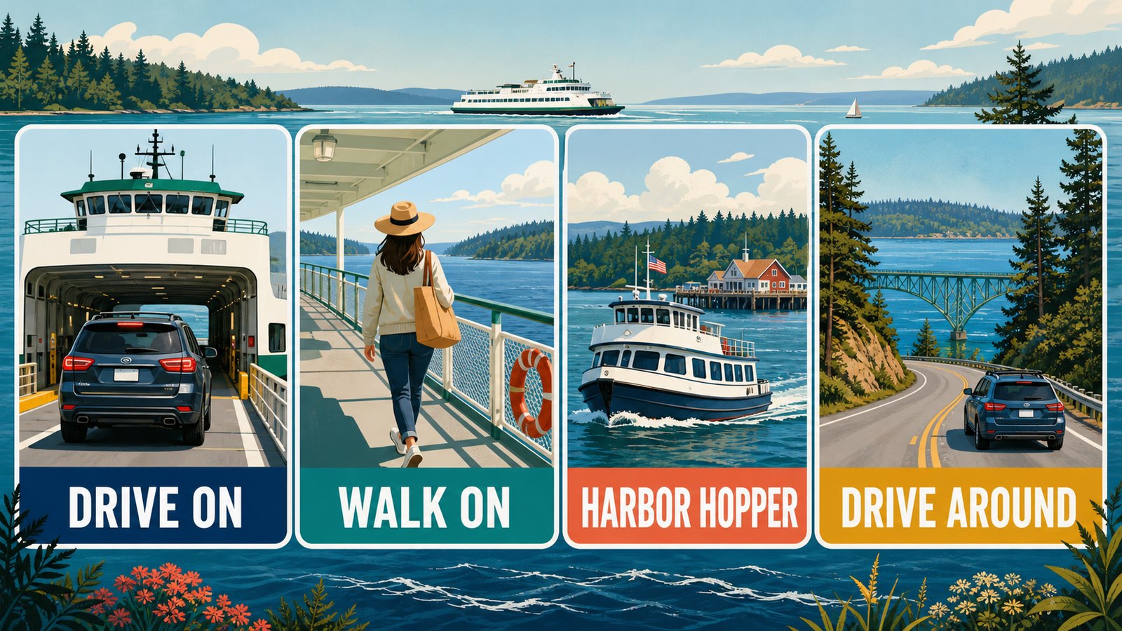
This guide is built for real trip decisions: when to use the Mukilteo-Clinton ferry, when walking on makes sense, how the new Everett-to-Langley Harbor Hopper changes summer day trips, and when a drive through Deception Pass or a Port Townsend-Coupeville reservation may be the smarter call.
Quick Takeaways
- Mukilteo-Clinton is still the main South Whidbey route for most visitors driving from Seattle, Everett, Tacoma, or the Eastside.
- Mukilteo-Clinton does not take vehicle reservations. Buying a ticket is not the same as saving a spot on that sailing.
- The new Harbor Hopper passenger ferry is scheduled to connect Everett and Langley on select Thursdays and Saturdays from June 4 through August 29, 2026.
- Use WSDOT tools before you leave home: schedule, alerts, cameras, estimated drive-up spaces, and the Best Times to Travel tool.
- Build your Whidbey day around ferry timing, especially on summer Fridays, Saturdays, Sundays, and holiday weekends.
The Main South Whidbey Route: Mukilteo to Clinton
For most South Whidbey trips, the practical ferry route is Mukilteo to Clinton. It connects the mainland at Mukilteo with Clinton on the south end of Whidbey Island, putting you within easy reach of Clinton, Langley, Freeland, Bayview, Maxwelton, and the rest of South Whidbey.
The crossing itself is short, but the full trip depends on traffic, ferry line length, sailing schedule, and whether you are driving or walking on. WSDOT’s current Mukilteo-Clinton route page is the best place to check the live schedule because schedule seasons change throughout the year.
Terminal Basics
Mukilteo terminal: 910 First Street, Mukilteo, WA 98204.
Clinton terminal: 64 South Ferrydock Road, Clinton, WA 98236.
WSDOT notes there is no parking available at the Mukilteo ferry terminal itself. Nearby paid parking is limited, so long walk-on trips may require a park-and-ride or transit plan before you get to Mukilteo.
One nearby paid option to know about is the Humphrey Road Ferry Parking Lot, located up the hill on the bluff with stairs that lead down toward the ferry area. Check current signs, rates, hours, and stair/access comfort before relying on it for a specific sailing.
Planning More Than a Visit?
Ferry timing, commute patterns, and route choices matter when Whidbey becomes more than a day trip. If you are comparing island communities or watching for the right home, Windermere Whidbey can help you connect the travel reality with the neighborhoods, homes, and daily rhythms that fit your plans.
Meet a local Windermere Whidbey agent | See our active listings | Search Whidbey properties
Do You Need a Reservation for the Whidbey Ferry?
This is one of the easiest places for visitors to get tripped up.
You cannot make a vehicle reservation for the Mukilteo-Clinton ferry. WSDOT’s ticket page says vehicle reservations are available only on the Anacortes/San Juan Islands/Sidney B.C. and Port Townsend-Coupeville routes. Mukilteo-Clinton is first-come, first-served.
You can buy ferry tickets online or at the terminal, but WSDOT is clear that a ticket does not guarantee space on a ferry. Think of the ticket as your fare, not a boarding reservation.
If you are using the Port Townsend-Coupeville route, reservations are a different story. That route is often useful for Olympic Peninsula trips and Central Whidbey plans, and reservations are strongly worth checking before you build a day around it.
How Much Does the Mukilteo-Clinton Ferry Cost in 2026?
Ferry fares can change by season, rider type, vehicle size, payment method, and tariff updates, so always use the WSDOT fare calculator before you travel.
As a snapshot checked on May 27, 2026, WSDOT listed these Mukilteo-Clinton fares:
- Adult passenger, age 19-64: $7.10.
- Senior/disability passenger: $3.55.
- Youth age 18 and under: no charge when not driving.
- Standard vehicle under 22 feet plus driver: $16.30.
- Vehicle under 14 feet plus driver: $12.95.
- Adult bicycle surcharge: $1.00.
- Motorcycle and driver: $7.35.
On the Mukilteo-Clinton route, WSDOT states that passenger and vehicle/driver fares are collected at Mukilteo, while vehicle/driver-only fares are collected at Clinton. Translation for many day-trippers: pay close attention to direction, vehicle size, and who is traveling with you.
How to Check Ferry Wait Times Before You Go
The ferry line can change faster than a static blog post can keep up with it, so use live tools instead of relying on someone’s old weekend memory.
Before you leave, check:
- WSDOT terminal cameras and wait-time information
- WSDOT route schedules and alerts
- WSDOT Best Times to Travel
- Low-tide warnings, especially if you are driving a large or low-clearance vehicle
One important detail: WSDOT’s estimated drive-up spaces are estimates. WSDOT notes they do not include vehicles already queued before the tollbooth, so the cameras are useful context when the terminal area is busy.
Best Ferry Strategy for Summer Weekends
Summer ferry strategy is less about finding one magic sailing and more about giving yourself options.
If you are driving onto the Mukilteo-Clinton ferry, plan around the ferry instead of treating it like a bridge. Friday afternoons, holiday weekends, sunny Saturdays, and Sunday return windows can all be busy. WSDOT recommends that vehicles on most routes be at the tollbooth at least 20 minutes before sailing, but busy summer travel can require more margin than that.
A few local planning habits help:
- Check the route schedule and terminal cameras before leaving home.
- Travel earlier in the day when you can.
- Avoid stacking a hard dinner reservation, event start time, or appointment right after your planned ferry arrival.
- Have a walk-on, transit, or drive-around backup if the line is already longer than expected.
- If you are visiting for an event, read event parking and shuttle notes before assuming you need a car all day.
For more South Whidbey summer planning, the South Whidbey Summer Music Guide pairs well with this ferry guide, especially if you are planning around Bayview, Langley, Freeland, or fairgrounds-area events.
New for 2026: Everett to Langley on the Harbor Hopper
The most interesting ferry update for summer 2026 is the new Harbor Hopper passenger ferry pilot between Everett and Langley.
According to the Port of Everett, Harbor Hopper is a foot-ferry service aboard the chartered Hat Island Ferry. It is scheduled to run on select Thursdays and Saturdays from June 4 through August 29, 2026, with two roundtrip sailings on operating dates. Each trip is expected to take about 30 minutes, with capacity for 45 passengers.
The Port lists one-way tickets at $12 and round-trip tickets at $20. Published operating dates include select dates in June, July, and August, but passengers should book and confirm through the Port of Everett before planning around a specific sailing.

Who Harbor Hopper Fits Best
- Everett-area visitors who want a car-free South Whidbey day trip.
- People planning a walkable Langley outing.
- Visitors who want to avoid summer vehicle ferry lines.
- Anyone pairing the ferry ride with downtown Langley, South Whidbey Harbor, galleries, food, theater, or summer music.
Who May Still Need a Car
- Families carrying beach gear, coolers, or bulky items.
- Visitors trying to cover multiple parts of the island in one day.
- Travelers headed to beaches or parks that are not easy to reach by foot or transit from Langley.
- Anyone whose return timing does not line up with the limited pilot schedule.
South Whidbey Harbor’s public dock and wharf put Harbor Hopper passengers close to Langley’s waterfront, shops, restaurants, galleries, and performing arts. The Port of South Whidbey also notes that the harbor has accessible restrooms, beach access, accessible fishing, and other visitor facilities.
Can You Visit Whidbey Without a Car?
Sometimes, yes. But the best car-free Whidbey trip is a focused trip.
If you walk onto the Mukilteo-Clinton ferry, Island Transit is the key on the Whidbey side. Island Transit is fare-free, and the agency notes that buses in Clinton are parked alongside the terminal building where walkers exit the ferry.
For Langley, the Port of South Whidbey and Island Transit visitor information point travelers from the Langley marina area toward the bus shelter at Anthes and 3rd, where Route 60 can connect to more of South Whidbey. Always confirm the current route and schedule before relying on it, especially for evening returns.
Car-free works best when your plan is simple: walkable Langley, a pickup from someone local, a transit-friendly stop, or a Harbor Hopper day focused around South Whidbey Harbor. It works less well when your itinerary includes multiple beaches, farm stands, parks, and dinner reservations spread across the island.
Should You Drive Around Through Deception Pass?
Driving around through Deception Pass can make sense, especially if you are coming from the north or heading to Oak Harbor, Deception Pass State Park, or North Whidbey. It can also be a backup when ferry lines are unusually long and you are not tied to South Whidbey first.
For a quick Langley, Clinton, Freeland, or Bayview trip from Seattle or Everett, though, driving around is often a bigger commitment. You are trading ferry uncertainty for highway miles, I-5 timing, and a much longer land route. It may be beautiful, but it is not automatically faster.
A good rule of thumb: if your destination is South Whidbey and the ferry line is manageable, Mukilteo-Clinton is usually the natural route. If your destination is North Whidbey, or if you are already north of Everett, Deception Pass deserves a closer look.
Where to Go After You Arrive
Keep the first stop realistic. If you arrive in Clinton, you are already at the island’s ferry gateway; the Clinton guide is a helpful local companion for nearby beaches, ferry-area context, and South Whidbey access.
If you are headed toward Langley, give yourself time to slow down. The Langley guide is the better resource for town-by-town detail, while this article stays focused on getting here without ferry stress.
For food-centered plans, the farmers markets and farm stands guide can help you build a seasonal loop once you know how you are arriving.
Thinking About Whidbey Beyond a Day Trip?
Ferries are part of daily life here, not just a visitor detail. If you are considering a move, second home, or more time on the island, it helps to understand how ferry timing, wells, septic systems, insurance, shoreline settings, and neighborhood access shape real ownership decisions.
Read the Whidbey buyer reality guide for a practical look at what is different about buying here.
Whidbey Ferry FAQ
Do you need a reservation for the Mukilteo-Clinton ferry?
No. WSDOT vehicle reservations are not available for Mukilteo-Clinton. The route is first-come, first-served.
Does buying a ferry ticket guarantee a spot?
No. WSDOT says a ticket does not guarantee a spot on a ferry. Tickets are fares, not reservations.
How long is the Mukilteo-Clinton ferry ride?
The crossing is short, but total trip time depends on the sailing schedule, terminal wait, traffic, and loading. Check the current WSDOT route schedule before leaving.
How much does the Whidbey ferry cost?
Fares vary by route, vehicle size, rider type, and travel date. As of May 27, 2026, WSDOT listed Mukilteo-Clinton adult passenger fare at $7.10 and standard vehicle under 22 feet plus driver at $16.30. Always recheck WSDOT before travel.
What is the Harbor Hopper?
Harbor Hopper is a 2026 passenger ferry pilot between Everett and Langley, operated aboard the chartered Hat Island Ferry on select Thursdays and Saturdays from June 4 through August 29, 2026.
Can you visit Langley without a car?
Yes, if your plan is focused and your schedule lines up. Harbor Hopper brings passengers directly to South Whidbey Harbor in Langley on select dates. Walk-on ferry passengers can also use Island Transit from Clinton, but should verify current routes and return timing.
When should you drive around through Deception Pass?
Driving around can make sense if you are coming from the north, heading to North Whidbey, or trying to avoid a very long South Whidbey ferry line. For most Seattle/Everett-to-South Whidbey trips, Mukilteo-Clinton is still the natural route when wait times are reasonable.
Written by Si Fisher