Facebook
 X
X
 Pinterest
 Copy Link


Coupeville Arts & Crafts Festival
August 8-9 | Coupeville
Two days of juried art, handmade goods, food, music, and summer wandering in one of Whidbey’s most photogenic waterfront towns.
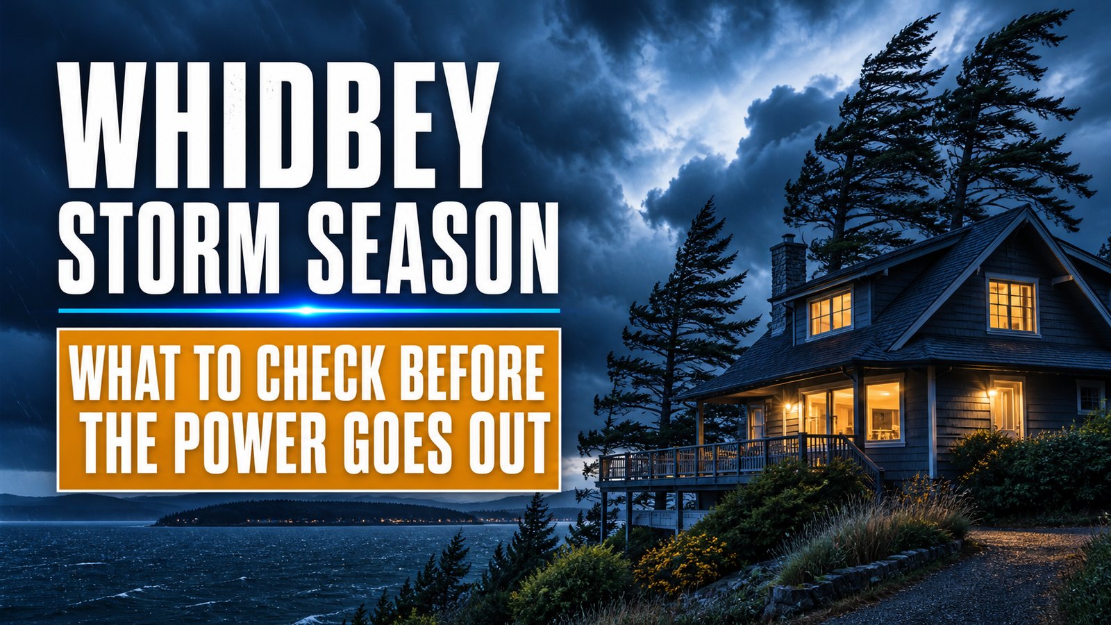
Image note: The visuals in this article are editorial guide images created to explain Whidbey Island storm and power-outage planning. They are not documentary photos from a specific place, event, business, property, or moment.
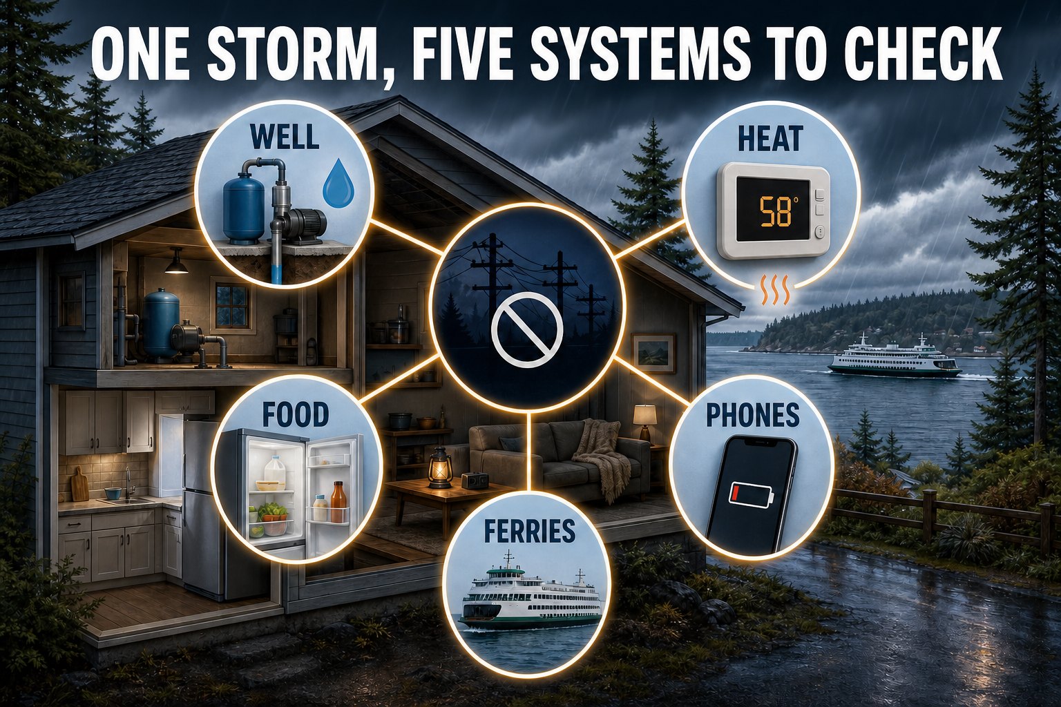
On Whidbey Island, a storm can become more than a bad-weather day. A power outage may also stop a private well pump, interrupt heat and communications, spoil food, complicate medical-device use, close roads, and disrupt one or both ferry routes. The useful question is not simply “Do I own an emergency kit?” It is “What should I check next, for this home, on this part of the island?”
This guide puts the core live tools together first, then walks through a practical sequence for the 48 hours before a windstorm, the final 12 hours, the outage itself, and the return of power. Conditions and official instructions can change quickly, so use the live panel as a starting point—not as a replacement for Island County, the National Weather Service, Washington State Ferries, or Puget Sound Energy.
[whidbey_storm_status]
The quick answer
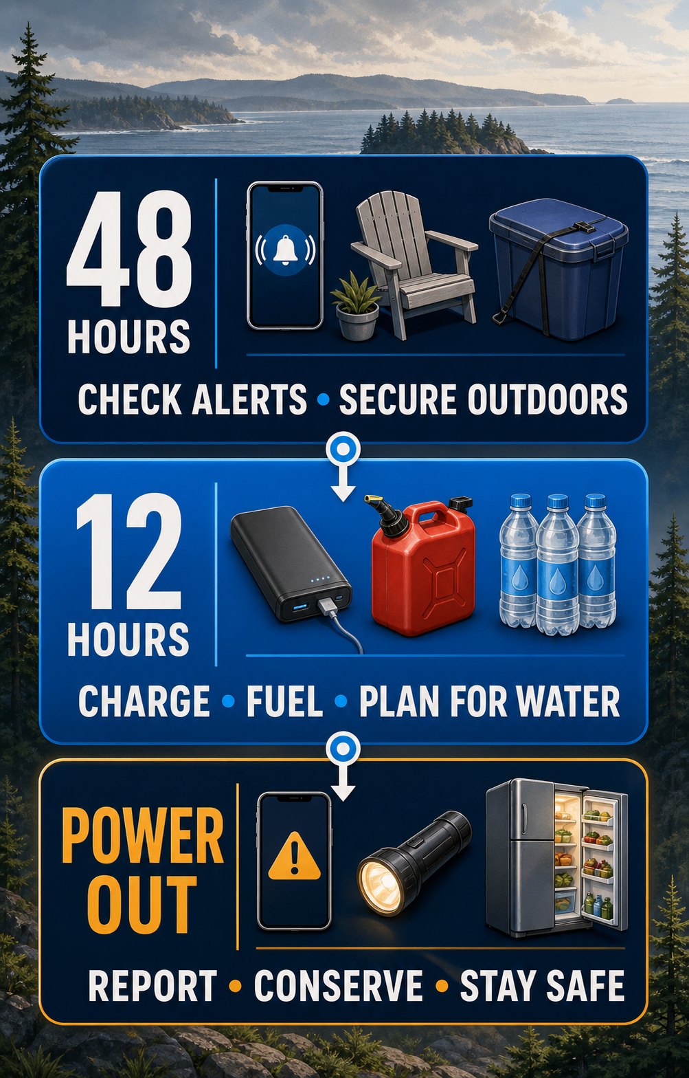
A useful storm plan changes as confidence in the forecast grows. Forty-eight hours out is the time to solve household problems. Twelve hours out is the time to finish charging, check live conditions, and avoid unnecessary travel. Once power is out, the priority shifts to electrical safety, heat, water, food, and reliable information.
Whidbey homeowners
Curious to know what it is worth in today’s market? Request a complimentary home valuation from a local Windermere Whidbey professional.
About 48 hours before
About 12 hours before
Do this now, not during the storm
Know how to release the electric garage door, where the electrical panel and water shutoffs are, which heat sources work without utility power, and how your well or pressure tank behaves during an outage. Label instructions so another household member can use them. If a system is unfamiliar, arrange professional guidance before severe weather—not while it is failing.
First determine whether the problem appears limited to your home. Check the electrical panel only if it is safe and dry. If the neighborhood is dark or you see utility damage, use PSE’s official outage tools. Island County notes that outages can disrupt communications, water, transportation, stores, fuel access, food storage, and medical devices—several systems that island households may rely on at the same time.
First 15 minutes
PSE says to assume every downed utility wire is energized, stay at least 35 feet away, and call 911 or the utility. Do not drive over a line or attempt to rescue a person or pet near it. If a line falls on your vehicle, stay inside unless fire or another immediate hazard forces evacuation; follow emergency instructions.
The FDA says an unopened refrigerator keeps food cold for about four hours. A full freezer holds temperature for about 48 hours, or about 24 hours when half full, if the door stays closed. When power returns, use appliance and food temperatures—not smell or appearance alone—to make decisions. The FDA advises discarding refrigerated perishables that have been above 40°F for four hours or more. Read the FDA’s current outage food-safety guidance for the full decision process.
During a prolonged Whidbey Island outage, churches, nonprofits, community centers, neighbors, and generator-powered businesses sometimes provide hot meals, coffee, warmth, Wi-Fi, or device charging. The important catch is that storm-specific help is usually activated case by case. A place that helped during one outage may be closed, without power, or serving a different population during the next one.
Check that the location is open, that the specific service you need is available, and that your route is safe. Never drive around barricades or approach floodwater, unstable trees, or downed lines to reach a resource. Call 911 for an immediate threat to life or safety; 211 is an information and referral service, not emergency dispatch.
During an active emergency
Check Island County Alerts & Warnings for activated facilities, public instructions, road information, and Communication Hub updates. The county has identified public libraries as possible hub locations, but says operational details are still being developed.
Sign up for Island County myAlerts before storm season so time-sensitive notices can reach you directly.
Food, shelter, and essential needs
Washington 211 connects residents with current meal, pantry, shelter, warming, utility-assistance, and other community resources.
Call: 211 or 1-877-211-9274
Text: 211WAOD to 898211
Online: Search the resource directory
The following are standing community programs rather than guaranteed storm shelters. Hours and services were checked on August 25, 2026, but outages, holidays, staffing, and program changes can affect availability. Call or check the linked page before traveling.
| Area | Resource | Standing service | Verify and locate |
|---|---|---|---|
| North Whidbey | SPiN Café 1241 SW Barlow Street, Oak Harbor 360-682-5949 |
Open daily 6:30 a.m.–5 p.m.; offers meals, daytime respite, and connections to community resources. Confirm the current meal schedule. | Official website Google Maps |
| North Whidbey | St. Augustine Catholic Church 185 N Oak Harbor Street, Oak Harbor 360-675-2303 |
Agape hot meal Monday evenings; Island County currently lists service from 4:30–6 p.m. | Official ministry page Google Maps |
| Central Whidbey | Coupeville United Methodist Church 608 N Main Street, Coupeville 360-678-4256 |
Island Senior Resources senior lunch Wednesdays from 11:45 a.m.–12:30 p.m. | Official website Google Maps |
| South Whidbey | Island Church of Whidbey 503 Cascade Avenue, Langley 360-221-6980 |
Free hot meals Tuesdays and Thursdays from 11:30 a.m.–1 p.m.; no eligibility restriction is currently listed. | Current program listing Google Maps |
| South Whidbey | St. Anthony’s Soup Kitchen at St. Hubert 804 3rd Street, Langley 360-221-5303 |
Island County currently lists Wednesday lunch from 11 a.m.–1 p.m. | County meal directory Google Maps |
For food banks and additional programs—including North Whidbey Help House, Good Cheer Food Bank, Gifts from the Heart, Queen-Bee Pantry, Whidbey Island Nourishes, and senior meal services—use the Island County food-bank and meal-program directory.
Whidbey businesses and neighbors sometimes create temporary gathering places when a long outage develops. During the December 2025 outage, Pickles Deli operated with generator power, heat, Wi-Fi, coffee, food, and a community meal fund. In December 2024, Bearly Awake Coffee Co. served residents from a generator-powered setup at Windjammer Park. These are examples of Whidbey’s community response—not standing promises for the next storm. Look for current, dated announcements and verify them before leaving home.
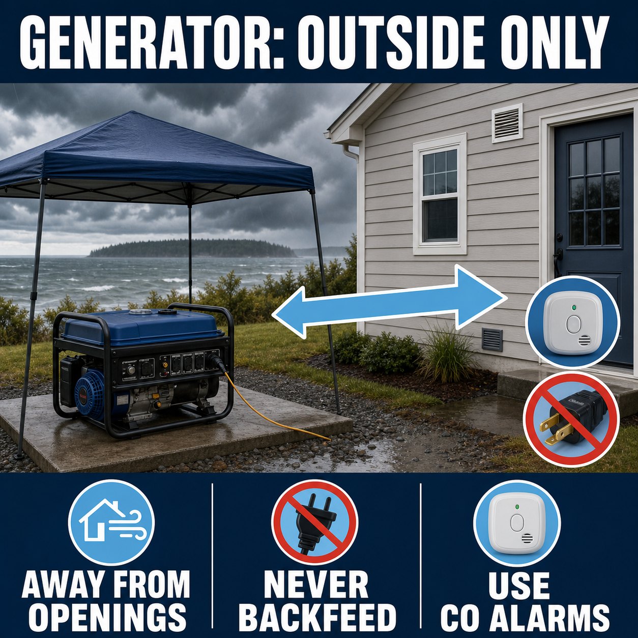
A garage with its door open is not a safe generator location. Neither is a porch, carport, breezeway, crawlspace, or partly enclosed shed. Operate a portable generator fully outdoors and away from doors, windows, and vents, following the manufacturer’s directions. PSE advises keeping the unit on a dry surface under an open canopy-like cover in wet weather and at least 10 feet from combustible surfaces.
Island County describes king tides as higher-than-usual tides that can produce local flooding even without rain. But a tide table is only one input. Wind direction, wave action, and atmospheric pressure can push observed water above or below the astronomical prediction. That is why the live panel labels the next predicted high tide without declaring it a flood event.
If official guidance warns of coastal flooding, move vehicles and portable items before water reaches the route or property, identify higher ground, and do not walk or drive through floodwater. For public shoreline planning and legal access reminders, see the Whidbey Island Beach Access Guide.
Whidbey’s two ferry connections are different systems: Mukilteo–Clinton at the south end and Port Townsend–Coupeville on Central Whidbey. Wind, vessel availability, terminal conditions, and tidal restrictions can affect travel plans. A reservation, screenshot, or schedule checked earlier in the day is not a live status report.
Restoration is a transition, not an all-clear. Give the electrical system a moment, then reconnect appliances in stages rather than switching everything on at once. Check food and refrigerated medication using the appropriate official guidance. Look for leaks, damaged branches, blocked access, and signs of electrical trouble—but never approach a line or unstable tree to inspect it.
Storm readiness is property-specific. Two homes on the same road may have different water sources, heat systems, tree exposure, shoreline elevation, cell coverage, driveway access, and backup-power options. Whether you already live here or are evaluating a home, verify the systems rather than relying on a general impression that a property is “storm ready.”
| System | Question to answer before a storm | Evidence to locate |
|---|---|---|
| Water | Will the well pump or treatment system work without utility power? | Well records, pump controls, pressure-tank details, stored-water plan |
| Heat | Which heat source can operate safely during an outage? | Equipment manuals, fuel plan, service history, working CO alarms |
| Backup power | What loads are supported, and how is power connected safely? | Generator rating, transfer-switch documentation, electrician records |
| Access | Can trees, drainage, snow, or shoreline flooding block the route? | Road maintenance, easements, alternate routes, tree assessment |
| Communications | What works when power, internet, or one cell carrier fails? | Battery backup, radio, alert sign-ups, neighbor plan |
For a broader look at wells, septic systems, ferries, insurance questions, and everyday island logistics, continue with What to Know Before Buying a Home on Whidbey Island.
Use Puget Sound Energy’s official outage map and report-outage page. The live panel near the top of this guide links to both. For a downed line or immediate danger, stay away and call 911 or PSE at 1-888-225-5773.
PSE’s website security settings do not allow the outage map to be framed on another domain. This guide links directly to the official live map rather than copying, scraping, or presenting a broken iframe.
The FDA says an unopened refrigerator keeps food cold for about four hours. A full freezer holds temperature for about 48 hours, or about 24 hours if half full. When power returns, use temperatures and current FDA guidance to decide what is safe.
Most electric well pumps stop. A pressure tank may provide a limited amount of water, but the amount and behavior depend on the system. Know your equipment, store drinking water before forecast high winds, and conserve water during the outage.
No. A garage is still an enclosed or partly enclosed space where deadly carbon monoxide can accumulate and enter the home. Operate the generator fully outdoors, away from doors, windows, and vents, following PSE and manufacturer instructions.
Check both Mukilteo–Clinton and Port Townsend–Coupeville if either could affect your trip or backup route. Also check the road between your location and the terminal, because a ferry may be operating while local access is disrupted.
No. A tide prediction describes the astronomical tide at a station. Wind, waves, atmospheric pressure, local drainage, and shoreline shape can change actual conditions. Follow official coastal-flood guidance rather than using one tide height as a universal threshold.
Check Island County Alerts & Warnings for facilities activated during the incident, and call 211 for current meal, shelter, warming, and utility-assistance resources. Island County also maintains a directory of standing Whidbey meal and food-bank programs. Because outages can close or change services, confirm the location and your route before traveling.
The panel requests refreshed information every five minutes and shows the last-check time. Source agencies may update on different schedules, and network or provider outages can delay data. Open the linked official source before making a safety or travel decision.
Official guidance, source links, image URLs, and live-feed behavior were last verified August 25, 2026. Weather, outages, tide observations, ferry service, roads, and agency instructions can change without notice. Always follow current official directions.
Written by Si Fisher

Image note: The visuals in this article are editorial guide images created to explain fall birding on Whidbey Island. They are not documentary photos from a specific place, event, business, property, or moment.
By late August, Whidbey Island may still feel like summer—but along its lagoons, wetlands, and tidal flats, fall migration is already changing the view. Southbound shorebirds pause to feed and rest, waterfowl begin gathering, and patient observers can watch flocks reshape themselves as the tide advances.
A productive outing is not about memorizing a long species list or racing between every reported bird. It starts with three choices: pick the right habitat, check the tide, and give the birds enough space to keep feeding. This beginner-friendly guide focuses on three useful Whidbey birding zones—Crockett Lake and Keystone Spit, Deer Lagoon, and Dugualla Bay Preserve—and a simple method you can reuse throughout the season.
Field checklist
A five-minute check can prevent a wasted drive and a disrupted flock.
Whidbey sits along the Pacific Flyway, a broad migration corridor connecting northern breeding grounds with wintering areas farther south. The island’s value comes from variety packed into a relatively narrow landscape: protected lagoons, freshwater and brackish wetlands, saltwater bays, exposed mudflats, spits, beaches, and forest edges.
For a migrating bird, these places are not scenic rest stops in the human sense. They are places to replace energy. Tidal mud can hold tiny invertebrates and other food; shallow water offers different feeding depths; nearby marshes and uplands provide cover and resting space. That is why the best birding strategy is habitat-first rather than species-first.
The Whidbey Camano Land Trust’s fall shorebird guide highlights Deer Lagoon and Crockett Lake among the region’s productive tidal areas. Current reports can help refine expectations, but migration remains dynamic: weather, tide, food, disturbance, and the birds themselves all affect what appears.
There is no single perfect tide for every species or location. Still, tide stage gives you a useful starting point:
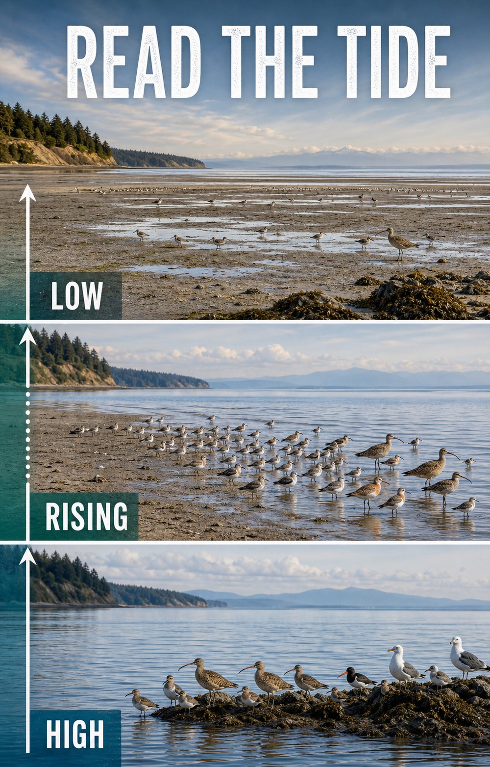
Use the NOAA tide-prediction station list to choose the station nearest your destination and select the date of your outing. For Central Whidbey, the Coupeville predictions are a useful planning reference. For North Whidbey, check the Crescent Harbor station. Local water levels and bird behavior can differ from a simple rule of thumb, so arrive ready to observe what is actually happening.
If your outing includes shoreline walking, also review the Whidbey Island Beach Access Guide for public-access, tide, dog-rule, and private-property reminders.
These locations are not ranked by guaranteed sightings—there are no guarantees in birding. They offer three different habitat combinations and enough contrast to teach you what to look for.
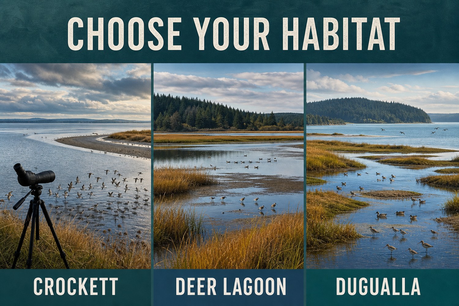
| Viewing zone | Habitat advantage | Best fit | Planning note |
|---|---|---|---|
| Crockett Lake + Keystone Spit | Lake, tidal flat, spit, beach, and open water | A first Whidbey birding outing | Check Fort Casey access and pass information |
| Deer Lagoon | Lagoon, marsh, mudflat, open water, and woods | Watching mixed shorebirds and waterfowl | Very limited residential parking; protect privacy |
| Dugualla Bay Preserve | Restored wetland, channels, brackish water, and bay | A North Whidbey habitat-focused outing | Confirm current preserve conditions before visiting |
Central Whidbey · Best first outing
Best for: Broad sightlines and several habitats from one general area.
Scan: Mud and shallow margins for shorebirds, open water for ducks, and posts or sky for raptors.
Access cue: Confirm Fort Casey notices and vehicle-pass requirements before leaving.
Crockett Lake is a natural starting point because one viewing area can place several habitats in front of you. The Whidbey Camano Land Trust describes the 423-acre Crockett Lake Preserve as a Pacific Flyway stop used by more than 230 bird species across the year.
Keystone Spit separates Crockett Lake from Admiralty Bay, adding protected-water and saltwater perspectives. A bird-viewing platform associated with nearby Fort Casey can make stationary scanning easier than walking toward a flock. Review the current Fort Casey State Park page, then open the Crockett Lake birding area in Google Maps.
For a longer Central Whidbey day, use the Guide to Coupeville rather than adding extra birding stops merely to fill an itinerary.
South Whidbey · Rich mixed habitat
Best for: Comparing shorebirds, waders, ducks, and woodland-edge birds.
Scan: Wet mud, shallow water, open lagoon, marsh edges, and the wooded approach.
Access cue: Parking is very limited in residential areas; keep roads and driveways clear.
Deer Lagoon lies along Useless Bay east of Freeland. The Whidbey Audubon Society’s Deer Lagoon guide describes a documented list of at least 211 species and a combination of marsh, mudflat, open water, and surrounding woods. It is especially useful for comparing feeding styles: small birds probing wet mud, longer-legged birds working shallows, and ducks using deeper water.
The common entry points are in quiet residential areas, and neighboring yards and beaches may be private. Carpool when practical, remain on recognized public access, and choose another destination if legal parking is unavailable. Open Deer Lagoon in Google Maps for general orientation, then follow Audubon’s access guidance rather than improvising a shoreline route.
North Whidbey · Restored wetland
Best for: A habitat-focused North Whidbey outing.
Scan: Channels and mud edges for shorebirds, open water for ducks, and nearby perches for raptors.
Access cue: Confirm current preserve directions and conditions with the Land Trust.
At Dugualla Bay, restored wetland and tidal habitats create another migration stop with a different feel. The Whidbey Camano Land Trust’s current Dugualla Preserves page identifies 201 protected acres with public access and bird-viewing opportunities.
Use Google Maps for Dugualla Bay Preserve, but check the Land Trust page before leaving. If you want food, services, or another non-birding stop nearby, the Guide to Oak Harbor can help with the rest of the day.
Fall shorebirds can be challenging because many are small, fast-moving, and dressed in subtler nonbreeding plumage. Begin with structure and behavior rather than forcing an immediate species name:
Species such as Western Sandpipers, Least Sandpipers, Dunlin, Sanderlings, dowitchers, and other migrants may occur in suitable Whidbey habitat, but no guide can promise what will be present on a particular visit. “Small sandpiper” is a valid field note until you have enough evidence to be more specific.
When practical, choose a viewpoint with the sun beside or behind you. Looking directly into reflected light can hide bill shape, leg color, and subtle plumage. Change your angle before walking closer.
Wind can shake binoculars and scopes and may push birds toward sheltered edges. Brace your elbows, lower a tripod, and scan protected shorelines rather than assuming the birds have left.
Standing still beside exposed water can feel cooler than the parking area. Bring a wind-resistant layer and keep the visit comfortable enough that you can watch patiently.
Simple gear that helps
Bring binoculars, a weather layer, water, and a notebook or phone for observations. A spotting scope is useful across broad mudflats, but a first outing can be rewarding with ordinary 8x or 10x binoculars. Avoid stepping closer just because your optics cannot resolve a bird.
eBird Hotspots can show recent visits and the species birders have reported at shared public locations. Use that information to understand what is moving through the area—not as permission to enter closed or private land, crowd a rare bird, or expect yesterday’s sighting to remain.
Merlin Bird ID can help narrow possibilities using location, date, appearance, and sound. Make your own observations first. Sound identification is a clue, not proof, especially when several birds are calling or the recording is faint.
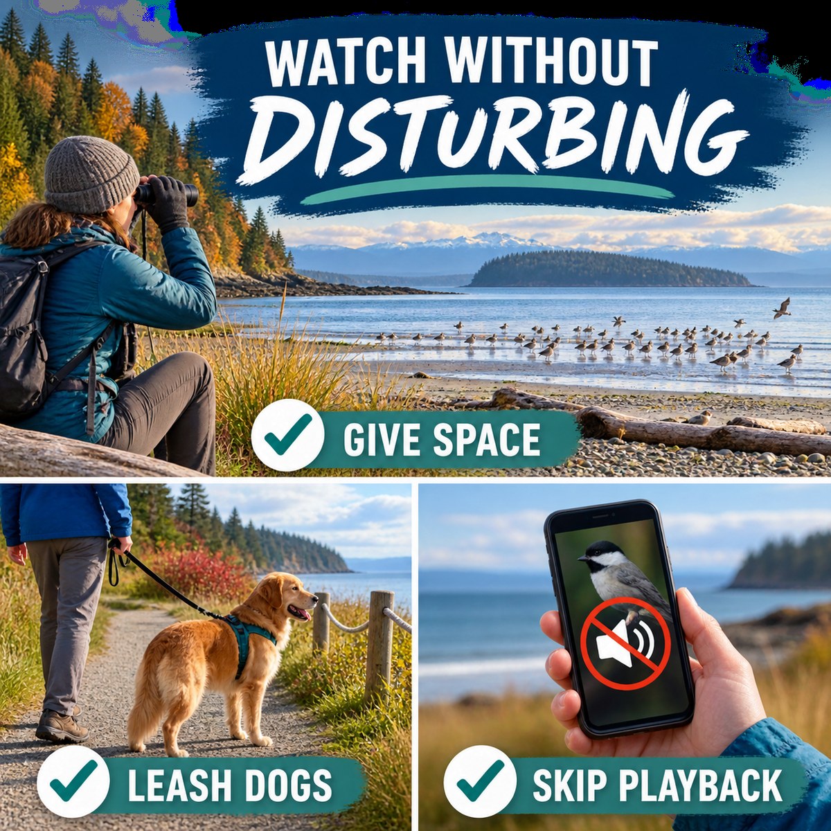
A shorebird on migration has a limited energy budget. Repeatedly forcing a flock to stop feeding or take flight can consume energy it needs for the next leg of the journey. Follow the American Birding Association Code of Birding Ethics and current U.S. Fish & Wildlife Service shorebird guidance:
Southbound migration is already underway by late summer and continues through fall, but different species move on different schedules. Weather, tide, food, and disturbance can change what is present from day to day.
A rising, mid-level tide is often useful because it can move feeding birds toward the remaining mud edge. At low tide birds may spread far across exposed flats, while high tide can cover much of the feeding habitat. Conditions vary by location, so check NOAA predictions and observe the site.
Crockett Lake and Keystone Spit are a strong first choice because the area combines lake, mudflat, spit, beach, and open-water habitats with broad viewing opportunities. Check the Crockett Lake Preserve and Fort Casey pages before visiting.
Binoculars make a major difference, and many birders find 8x or 10x magnification practical. A spotting scope helps with distant birds on broad flats, but it is optional. Never close the distance if doing so disrupts the birds.
Check the rules for the specific site. Where dogs are permitted, keep them leashed and well away from feeding or resting flocks. Leaving a dog at home is often the most wildlife-friendly choice for a shorebird outing.
Use eBird’s Explore and Hotspot tools to review recent public reports, then confirm access through the official land manager. Treat reports as context rather than a guarantee or permission to enter private or closed areas.
Playback means playing a recorded song or call from a phone or speaker to make a wild bird respond or come closer. Birds may interpret it as a rival, mate, flock member, or warning and stop feeding, leave cover, or spend energy investigating. Use headphones for identification audio or wait until you have left the viewing area.
It varies. Deer Lagoon has especially limited parking in residential areas, so keep driveways and roads clear and choose another site if legal parking is unavailable. Check official pages for current access, closures, and parking information before leaving.
No. Migration changes daily, and even a recently reported bird may have moved. A successful outing is learning to read habitat and behavior while observing whatever is present without disturbance.
A quieter outing often reveals more than a hurried islandwide checklist. Check the tide, settle into one legal viewpoint, and watch how birds respond to water, weather, and one another.
Continue planning with the Whidbey Island Beach Access Guide, the Guide to Coupeville, or the Guide to Oak Harbor.
Information and public-access details were last verified August 18, 2026. Migration activity, tide conditions, parking, hours, closures, pass requirements, and site rules can change. Check linked official sources before visiting.
Written by Si Fisher

July handed Whidbey Island one of those real estate stories that sounds contradictory until you look under the hood: more homes were available, fewer buyers committed, fewer sales closed, and the median closed price still moved higher.
Compared with July 2025, active residential and condo listings across areas 811, 812, and 813 increased 13%. New listings fell 12%, pending sales fell 26%, and closed sales fell 10%. Meanwhile, the islandwide median closed price rose from $602,000 to $635,000.
New listings were actually lower than last July. Active inventory still rose because existing listings took longer to clear while fewer new contracts entered the pipeline. The island did not receive a sudden delivery truck full of houses. The shelves simply emptied more slowly.
More inventory is not a coupon code. It changes the conversation, but the address, price point, condition, and competition still write the fine print.

A waterfront home near Greenbank, an in-town Coupeville cottage, a Freeland condo, and an Oak Harbor neighborhood home are all Whidbey real estate. They are not all the same market.
Active listings fell from 154 to 140, while July closings rose from 25 to 38. With 3.8 months of inventory, South Whidbey remained balanced rather than bargain-bin dramatic.
Active inventory climbed from 53 to 80 while closings held at 14. Inventory reached 5.9 months, putting Central Whidbey closest to buyer-favorable conditions.
Active listings rose from 135 to 168 while pendings fell from 70 to 44. North Whidbey remained neutral overall, but sellers faced a more selective audience.
A median measures the middle of what sold, not the value change of every home. If fewer lower-priced properties close and more sales occur in higher brackets, the median can rise even while overall demand softens.
That mix effect appears in the price bands. South Whidbey gained sales in several middle and upper brackets, Central Whidbey shifted unevenly, and North Whidbey recorded substantially fewer sales below $400,000. The islandwide median did not make that complexity disappear. It merely gave it a tidy name tag.
Open an area to compare 2025 and 2026 sales. These charts use ordinary HTML and CSS rather than scripts or SVG.

Homes still sold, and well-positioned properties could still move quickly. Buyers simply had more alternatives and less reason to overlook an ambitious price, deferred maintenance, awkward presentation, or a location mismatch.
The right interpretation depends on location, condition, property type, competition, and price range. A local market conversation can separate useful leverage from wishful thinking.
Market data was supplied by NWMLS and local Windermere Whidbey market reports. Different reporting tools may produce slightly different counts because of timing and status definitions. Price segments, property types, condition, location, and Whidbey micro-markets can move differently, and the data may not reflect all real estate activity. Buyers and sellers should talk with a local real estate expert about their specific property or search.

August on Whidbey Island has that glorious late-summer energy: music in the parks, art in the streets, gardens in full leaf, market baskets filling up, and a few big weekends where the whole island seems to be out and about at once.
Whether you are planning a family day in Coupeville, a concert evening in Langley, a garden afternoon in Greenbank, or a full festival weekend, this month is packed with ways to enjoy Whidbey. Use this guide as a starting point, then check the official event links for tickets, weather notes, parking, ferry timing, and last-minute updates before heading out.

Also watch the mid-August weekend for the Whidbey Working Artists Studio Tour on August 15-16, when island artists open their studios for self-guided exploring.


Island Shakespeare Festival continues its Summer 2026 season, July 17 through September 6, with Macbeth and Robin Hood of Sherwood Forest under the summer sky in Langley.
Whidbey Plein Air Paint Out runs August 17-24, bringing artists outdoors to paint island light, water, farms, streets, and shorelines in real time. It is a lovely excuse to spend time in Coupeville and keep an eye out for easels tucked into scenic corners.
WICA’s August calendar includes the Pacific Northwest Conducting Institute Finale Concert on August 7, John Roberts y Pan Blanco on August 8, Rebecca Albiani’s Mannerist Gardens art talk on August 12, Cozy Comedy with Kyle Kinane on August 15, The People’s Hospital screening on August 21, and Unscripted: Bobbe Bridge & Mary Yu on August 22. See WICA Events
Smaller creative stops include Poetry Night at South Whidbey Commons on August 7, the Island Form reception at Koneksi Gallery in Clinton on August 8, and late-August improv events from Whidbey Improv.

Meerkerk Gardens has more than bluegrass this month. Guided Forest Walks are scheduled August 2, 16, and 30, and a Summer Garden Tour is scheduled August 22. These make great options for visitors who want a quieter afternoon among trees, trails, and late-summer blooms. Meerkerk Tours
Schooner SUVA sailings also appear throughout August from Coupeville, offering a classic Penn Cove summer experience. SUVA Schedule Listing

Farmers markets are steady through August: Bayview Farmers Market on Saturdays, Oak Harbor Farmers Market on Thursdays, North Central Whidbey Farmers Market on Fridays and Saturdays, and South Whidbey Tilth Farmers Market on Sundays. Bring a tote, make a picnic plan, and let the berries and flowers do some of the itinerary work.
Food and benefit events include Feed Your Soul: Benefit Concert for Whidbey Island Nourishes at Dancing Fish Vineyards on August 16 and Oysters & Beer with Salinity and Thirsty Crab in Clinton on August 16.
The Healers Festival takes over Coupeville Recreation Hall on Saturday, August 22, from 10 AM to 6 PM with a day of wellness, workshops, practitioners, artists, and community connection.
Library and learning events include Mocktails & Masterpieces at Langley Library on August 6, Hummingbirds: Masters of the Air at Clinton Community Hall on August 11, Jigsaw Puzzle Exchange at Freeland Library on August 23, and Board Game Afternoon at Langley Library on August 29.
Early September brings Bayview Corner Street Dance with Ike & the Old Man on September 2 and Oak Harbor Music Festival over Labor Day weekend. If your August calendar is already full, those are worth saving for the next round.
Big August highlights include Coupeville Arts & Crafts Festival, Meerkerk Gardens Bluegrass Festival, LittleBIGFest, Tour de Whidbey, Whidbey Working Artists Studio Tour, Langley Street Dance, and NAS Whidbey Island Open House.
Look for Tuesday Concerts in the Park in South Whidbey, Bayview Corner Street Dances, Oak Harbor Sounds of Summer, WICA Summer Nights, the American Roots Concert Series at Deception Pass, and Coupeville’s free summer concert.
Good family-friendly options include Coupeville Arts & Crafts Festival, farmers markets, Langley Street Dance, South Whidbey Concerts in the Park, Island Shakespeare Festival, Meerkerk garden walks, Toy Boat Workshops, and the Military Appreciation Picnic.
Book ahead for LittleBIGFest, Meerkerk Bluegrass Festival, Tour de Whidbey, WICA ticketed events, bioluminescence kayak trips, schooner sailings, Oysters & Beer, and limited-capacity workshops or performances.
For weekend events, check ferry wait times before leaving, give yourself extra travel time, and consider arriving early enough to enjoy nearby shops, trails, parks, or restaurants before the event begins.
Written by Si Fisher.


Want to join the Windermere Team?
Click here for Freeland / Langley
Windermere Real Estate/South Whidbey

© 2023 Windermere real estate